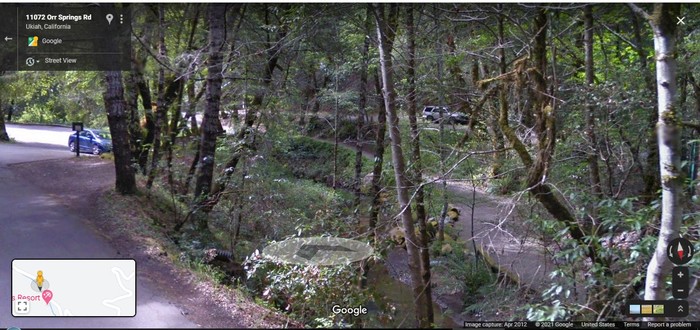
The Entrance Bridge To Orr Hot Springs Resort Is 200 Ft Ahead, At Blue Car. There The Road There Widens For A Turnoff .
A Google Street View (GSV) Screen Capture Photo, Shows A Small Portion Of The South Fork Big River (SFBR), Along The Orr Springs Road, Which Is The Same As Californias Comptche-Ukiah Road.
At Right Of Center (In Opening Between Trees), The Water Of This Medium Sized Stream, Can Discerned.
Now, Beyond The Small Dead Tree Branch, You Can See Some Whitewater Shallow Rapids, And Then Looking Higher Up, See The Streams Sandy Edges, At Bottom Of The Bank Of Opposite Side Of The Stream.
This Stream (SBBR) Going By Here Is Medium Sized, Because It Is Near The Upper Reach Of Its Watershed.
.[ We sleep and when we wake up I feel very rested, more rested than for a long time. I take Chriss jacket and mine and tuck them under the elastic cables holding down the pack on the cycle.
Its so hot I feel like leaving this helmet off. I remember that in this state theyre not required. I fasten it around one of the cables.
."Put mine there too," Chris says.
."You need it for safety."
."Youre not wearing yours."
."All right," I agree, and stow his too. ]
The road continues to twist and wind through the trees.
(Cont Next)
.**************
.
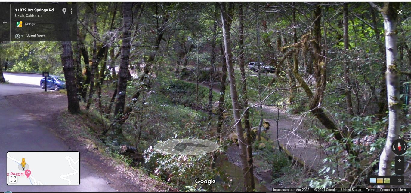
Orr Hot Springs Resort, The Most Likely Place for The Narrators 1968 A Picnic Table And Narrow Ravine.
..A) ~32.1 Road Miles East of Mendocino, CA and.
..B) ~12.2 Road Miles West of Ukiah, CA.
As Was Stated In Previous Photo => Despite Best 2002 ZMM Route Research Efforts, Henry Gurr Has No Photos Of Narrators Picnic Table.. Or Narrow Ravine.
.Having no other suitable Photos, Google Street View (GSV), Comes-To-The-Rescue, as you see /\ Above /\ and Other Photo in this Album.
A NOTE RE /\ ABOVE /\ PHOTO:
..Look Closely At Botton Center, See Word Google And Above See Faint White GSV Oval With /\ Inside.
Now, looking slowly to the right of this Oval, you can see Green Grass sloping down to Waters Edge. Further to right, in open space of branches (as mentioned above), you can see the light gray of the water surface, and in center see some White Water. (and as also mentioned above), Looking Higher Up You See The Sandy Edges At Bottom Of The opposite Bank Of The Stream.
************************
DATE-LINE: February 17, 2021 by Henry Gurr.
MORE DISCUSSION OF ZMM ROUTE RESEARCH, ALONG CALIFORNIAS COMPTCHE-UKIAH ROAD.
.Using The FOURTH Blue Link Below For A TopoZone Map. We can see one of the few reasonable places along the road, where there is a Valley Scene, somewhat like The ZMM Narrators a small ravine , & visible from the road & a reasonable place that in 1968 might have had a a picnic table, that was visible from the road. This Reasonably Could Have Been At "Orrs Springs", which is approximately 36 road miles from the Sharp Switch Back On Point Cabrillo Dr., an appropriate distance to fit the ZMM narrative.
After Having Determined That The Orr Hot Springs Resort Is Practically The Only Place That Fits The Narrators Descriptions,
I decided to determine the extent to which the ZMM Narrators a small ravine, is visible from the road.
For this purpose, Click Here To Do Your Own GSV Drive, In Either Direction..
For Example: I Started From The Location Of Orr Hot Springs And Completed A GSV Drive =>
A) Going West, on Orr Springs Road as far as Comptche, CA but did not see any good candidates.
B) Going East on Orr Springs Road as follows =>
1) GSV Drive on relatively level read, then ~90 deg left turn, and climb to 2nd ~90 deg left turn, then a right turn switchback, continued climb to a left turn switchback, and here stop, and rotate view to a bit right of South.
2) After completing 1) above, you will be able to see the V-Shape of a large looking Valley, which might be called by the ZMM Narrator a small ravine .
C) =>
. Click Here To See A Google Street View Of The Above Mentioned V-Shape Of A Large Looking Valley. This I believe is what the ZMM Narrator called a small ravine
************************
You Can Study The 1) & 2) On A TopoZone Map, Blue Link Below =>
A) You Can Pick Out What Might Be The ZMM Narrators a small ravine . by finding (center screen), the black dot marking Orr Springs, Then study both sides of stream that is to the Southeast.
B) You Can Further Conduct Your Own Study, Along Californias Comptche-Ukiah Road, Using TopoZone Map =>
RIGHT CLICK AND SELECT NEW TAB => After Map View Comes Up, You Will See A Clutter of Adverts That Are Impossible To Eliminate => YOU BEST SHOULD =>
.Use Scroll Bar At Far Right => Adjust Green Topo Map Until You See JUST BELOW The Plus&Minus Upper Left. => A ClickOn For Full Scree. Click On It, And Adverts Will Be GONE.
.Then use, The Plus&Minus To Zoom. You can Click&Drag Map In Any Direction, and See More Off Your Screen Edges.
Now you are ready to do the above A) and B).
*************************
(Photo = GoogStVu WhtWater&EdgSForkBigRv}OrrHotSpringsResort11072OrrSpringsRdUkiahCA.jpg ...... ZMM Page = 371 ...... WayPt = Is At /\ Above /\.Photos GPS Coordinates given In the Blue Link, Or Alternatively At Top of The Above-Mentioned TopoZone Map. )