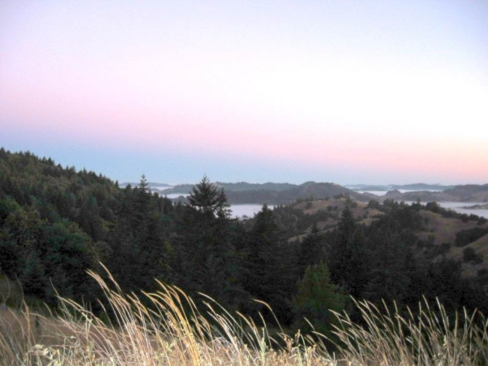
Standing At The Highway Edge & Looking A Bit North of West, As You Can See That This Photograph Is Taken At This Roads Highest Elevation (2,209 ft).
Looking Beyond The Distant Low Mountains, We See The Sunrise Venus Belt Glow. This Could Symbolizes Right Attitude, In Forthcoming Photo.
..[ The road continues to twist and wind ] through the trees. It upswings around hairpins and glides into new scenes one after another around and through brush and then out into open spaces where we can see canyons stretch away below.
."Beautiful!" I holler to Chris.. (Cont Next)
..
In Backcountry At ~10460 Orr Springs Road, Traveling Towards The ZMM Route Town Of Ukiah, CA. =>
A) ~34.8 Road Miles East of Mendocino, CA and.
..B) ~9.5 Road Miles West of Ukiah, CA.
A NOTE RE THE /\ ABOVE /\ PHOTO:
The gap between the Closer High Forested Mountain at left & and Lower Forested Small Mountain at Center, is where the Switchbacks of the road come up to a slight hill, and then arrive at the /\ Above /\ Camera Vantage Point. => To see this in a Satellite View, click the Blue Link Below, and study Twisty Road North of the Red Pinpoint.
SOUTH FORK BIG (REDWOOD TREES) RIVER: CONTINUED EXPLANATION.
.On This Comptche Ukiah Road Backcountry Road, As You Travel East Towards The ZMM Route Town Of Ukiah, CA
And After Comptche, CA
You Will Come Into The Valley Of The South Fork Big River (Elevation ~610 ft):
This South Fork Big River was previously crossed over on the Pacific Coast Highway Rt-1, South of Mendocino,
And The Comptche Ukiah Road continues in the valley of the South Fork Big River, until just after Orr Springs, CA (Elevation~880 ft). Here the road leaves the valley, and does a Many Zig Zag-Switch Back Climb (+346 ft), To A Ridge Top (Elevation ~2,209 ft), where the /\ Above /\ Photo came into view!
. RIGHT CLICK AND SELECT NEW TAB => After Satellite Map View Comes Up, You Will See What Is Most Likely The ZMM Route, Which Is Along => Orr Springs Road. You Will See This Roads => Twists & Sharp Turns, Among Hills of Dry Brown Grass, Spotted With Clumps Of Dark Green Trees. AFTER This Satellite View comes up => ClickOn The Plus&Minus To Zoom. You can Click&Drag The Map In Any Direction, To See More Off Your Screen Edges.
.In This Satellite View, The Red Pinpoint Marks Henry Gurrs /\ Above /\ Photo at WayPt 471.
NOW
You will find it particularly interesting to ClickDrag the Satellite View, to follow the Orr Springs Road, at first North, and then West until you see Orr Hot Springs Resort. In doing this follow the road => You will appreciate the Many Zig Zag-Switch-Back Climb, and immediately see why => Both the Comptche-Ukiah Road and Orr Hot Springs Road come up high, as Favorite Scenic By-Ways in Google Searches!!
HOWEVER, Please Be Aware That This Road, Has Lesser Quality Of Construction Than Normal State Highways.
For example: Some places the pavement edge may have an 8 inch drop off, to the roadside dirt. I found this out the hard-way, by tuning off the pavement to a wider place to rest & write-out my ZMM Route Research Notes. Suddenly the right tires dropped enough, so the frame of my car was grinding grunch to a stop. AND my tires off the dirt so much the wheels spun & smoke, when I tried to drive forward! :-((
CA.
. A SECOND NOTE RE THE /\ ABOVE /\ PHOTO:
.The distant low areas. are filled with chilled, early morning ground fog, which looks like water but is not!
.Please study the strip of Pink Sky Glow, which most often has a strip of Blue Glow below it. This Pink is called The Belt of Venus, and happens when the atmosphere is relatively clear just before sunrise. The Strip of Blue Glow below is due to the earths shadow, and gets narrower, as the sun comes closer to sunrise. It will take you some thinking to realize why this happens.
You will see The Belt of Venus ALSO just after sunset, where the strip of Blue Glow, gets wider as the sun sets lower, until darkness.
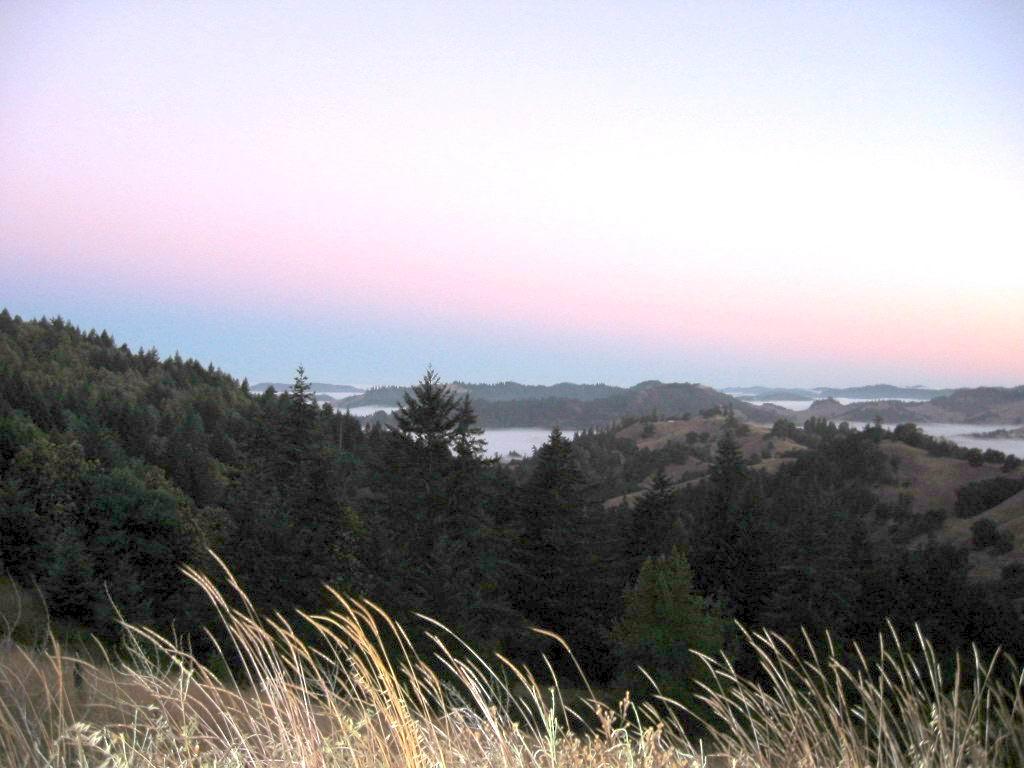
Also, you will see this Belt of Venus to varying degrees in other photos in this Album; For example, the Next & THIRD Next Photos.
************************************
(Photo = 117-1734b ...... ZMM Page = 372 ...... WayPt = 471 2209ft)