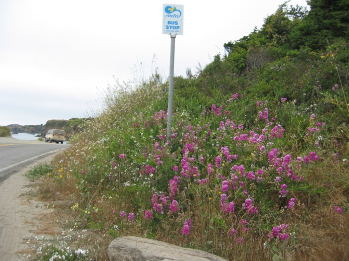
Author Robert Pirsig In 1968, Would Have Followed The Old Rt-1, Which Went Down To and Along A Public Beach Located At The Back Of Caspar Anchorage. (A Small Bay & Harbor.)
…At Left, You Can See The Water Of This Bay, And The Beach Runs Along Between The Water And The Pavement.
…You Can See More Of The Bay, To The Right Of The Vehicle’s Back Tire.
…[ “Instead we climb on the cycle and go slowly south looking for a restful place to pull off.] .. The road leads out to the ocean again …. ” (Cont Next)
Back-bay Beach Park, about one travel mile South of Caspar, CA.
As Discussed In The 3 Previous Photos =>
…Most likely Author Robert Pirsig back in1968, would have followed the then existing Rt-1 main coastal highway. This would have gone through the Caspar business district, descended down a hillside, onto a curved wooden trestle, on which Rt-1 crossed Caspar Creek and reached practically ocean level.
… Rt-1 would then go along the back of a small beach (cove) seen in the /\ Above /\ Photo. And then after going over Doyle Creek, swing around to the Northwest, and climbed up the opposite (South) hillside to the level headlands. Here is where the Narrator says “a restful place to pull off. .. The road leads out to the ocean again ….
…I believe this above route description is the road most likely used by Author Robert Pirsig, since it well fit his statement “The road leads out to the ocean again.“
…This above route description also, in fact, leads to a location of the Narrator & Chris climax scene, on a map sent to me by Mr. Pirsig. To See Mr. Pirsig’s March 28, 2002 Letter Click Here. And AFTER this page comes up, scroll down to the first March 28.
…The NEXT Photo, shows and discusses The Approximate Location That The ZMM Narrator Calls A High Point
*************************
(Photo = 117-1713 ...... ZMM Page = 366 ...... WayPt = 464w 0040ft)
