The Mountain Climb Starts Off Easy, Following A Well-Traveled Level Path =>
Which Is High Up On the Side Of Cottonwood Creek Canyon.
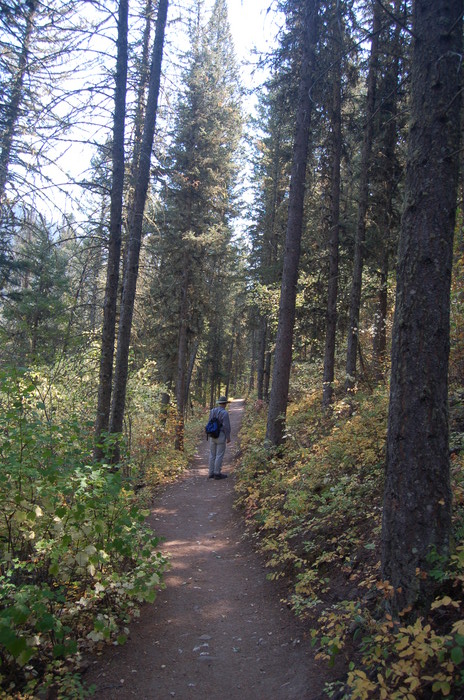
.In /\ Above /\ Photo, You Can See The Path On A Steep Slope, And =>
You Will Have To Imagine Cottonwood Creek, Is Way Down At Left.
.Chris and I have had a good nights sleep and this morning have packed the backpacks carefully, and now have been going up the mountainside for about an hour. .. The forest here at the bottom of the canyon is mostly pine, with a few aspen and broad-leafed shrubs. Steep canyon walls rise way above us on both sides. Occasionally the trail opens into a patch of sunlight and grass that edges the canyon stream, but soon it reenters the deep shade of the pines. The earth of the trail is covered with a soft springy duff of pine needles. It is very quiet here.
Cottonwood Canyon, Gallatin National Forest, MT. What was the ZMM Narrator's trail in the mountains after he left the DeWeese Family? On page 173 he says, Just up above the top of the ridge the snow can be seen now.
.So, where is the Narrator's trail?
.We must use topo maps and ALL the Narrator's clues, even TINY ones, to deduce his trail. Early in Part III, he says that he started at the DeWeese's and followed the stream up a narrow canyon. And he moves directly towards the (closest?) snow, and this snow is visible while they are deep in this narrow canyon. Most likely these are the mountains in the Southeast.
.Indeed, there is a 1.2 mile stretch of Cottonwood Canyon that does point, up canyon, directly at some very high snow peaks (over 10,000 feet) in the Gallatin National Forest, such as Mount Blackmore and Elephant Mountain.
.Given these crucial clues, a ridge fitting the ZMM Narrators descriptions is identifiable. Having thus identified a probable "ridge" on the North side of and parallel to Cottonwood Canyon, another connecting ridge that then could lead a climber to snow, may be identified. See link to map previous photo. Continued next.)
NEW TOPIC:
.The Narrator probably used Topographic (Topo) Maps to explore both of these high
country This is very likely, because he tells us on his check-off list U. S. Geodetic Survey maps of an area where we hope to do some hiking. (See his list of travel and camping gear , Early in ZMM Chapter4, p 036) I infer that these maps were used to plan the Part III climbing route and regularly check their course during that climb. These very maps (or similar), were likely on Pirsigs desk during the 4 years he planned, and did his writing of, the high country and mountain hiking portions of ZMM. (Continued next)
*************************
(Photo = September2006 0131...... ZMM Page = 167 ...... Photo Simulate WayPt = N+C 03 = 1.11 mi fm DeWeese.)