View Northeast: Cottonwood Canyon Near the DeWeese Homestead.
.Chris and I should do some climbing up to where that wind starts.
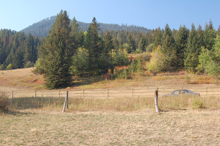
Lower Cottonwood Canyon, Gallatin Gateway, MT Each of (the Next 32) Photos=>
.That Illustrate The "N+C Hypothetical Climb Trail ", for each N+C ##) => And thus INCLUDE the respective N+C WayPt Number.
Please be aware that => This Number is to be associated to the same WayPoint on respective Topo Maps, as discussed the Previous Photo. (NOTE: To Access Topo Maps, Right Click, SECOND Blue Link Below. and Open In New Tab.)
.CAUTION: The NFS Cottonwood Creek Trail marked as ----on my map, follows Cottonwood Creek and thus initially is on private land. At parking lot (N+C 02 on my map), follow trail marked by signs. This stays on NF land.
. SIDE NOTE: Based on the Narrator's statements, about when their trip took place, would date their Mountain Climb on or around 17 July 1968. Thus a proper set of trail photos illustrating the Narrator's Climb would show a mid-summer's lush green. Many of my 2002 Photos show mid-summer green.
However, the next 5 (and many of my other photos), were taken 10 September 2006, and show, by contrast, dry-season brown grass and early fall tree colors. This is, of course, due to the rapid change of season in High Mountains and Northern Latitudes.
I apologize for a) Not being able to visit & photograph this forest at a more realistic time of year. b) And for not yet finding the opportunity to explore and photograph a full trail, as described in ZMM
Since my trail marked on my "Hypothetical Climbing Trail Map" is as yet only partly verified by Mr Joe Pioro, trail enthusiasts are invited, indeed STRONGLY urged, to volunteer their skill to a field check this map.
Right Click, And Open In A New Browser For =< Instructions And Link To ZMM Bozeman Mountain Hypothetical Climb Trail Topo Maps. If you are looking at my Topo Maps in This Album => Plz remember to Click Map Photo several times to get largest version, AND THEN hold CTRL and press the + Plus Key, to Make Topp Map Even larger.
**********************
ATTENTION Before You Continue To View This Album, You Might FIRST Want To View The More Realistic 63 Photo Album Of =>
Amateur Mountain Climber, Joe Pioro, Researched & Photographed => The Most Likely Gallatin National Forest Mountain Route That => Fits The ZMM Books Narrator + Chris Climb Narrative.
INSTRUCTIONS:
Click on the Blue Link below, and after the 5 Albums Page comes up Read the description of the THIRD Album =>
SUPPLEMENTARY PHOTO ALBUM FOR ZMM BOOK PART 3
Then when ready click on the photo to see the first of four pages of 18 Small Photos. Click Here To Go To 5 Albums Page.
. **********************
(Photo = September2006 0100 ...... ZMM Page = 154...... Photo Simulate WayPt = N+C 01cont = 0.20 mi fm DeWeese.)