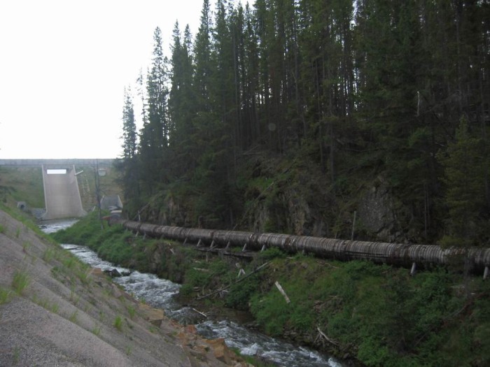
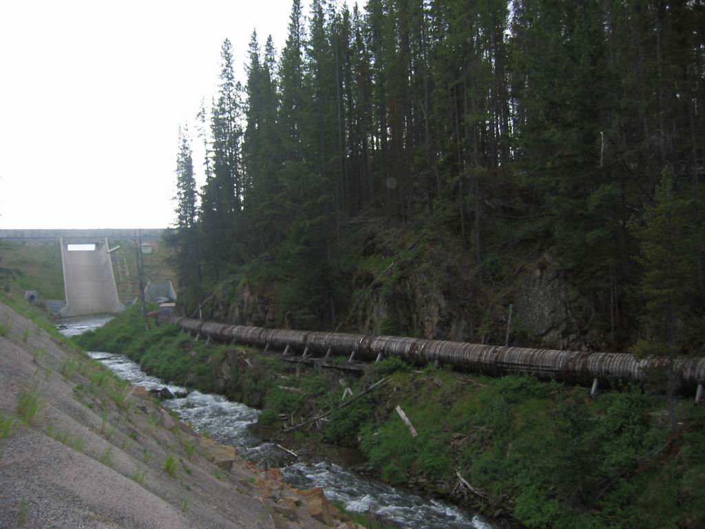
Looking Back, We See the Road, the Stream, a High Concrete Dam, AND a Huge Iron Banded Wooden Water Pipe (Aqueduct), Which In A Local Water Planning & History Document Is Called A 60 Inch Wooden Stave Pipe.
.
. that the morning is almost ended.(Cont.next)
A bit more West of Silver Lake, MT. The dam in the distance would seem to provide water for the pipe which we might assume is for agriculture irrigation and city water for the towns further West. By appearances, the pipe seems over ~100 years old and no longer seems to be carrying water.
.****************..
Why Was This Huge Pipe Placed Here?
.To find the answer I of course Googled For =>
. Silver Lake, MT. Iron Banded Wooden Water Pipe, Agriculture Irrigation ~100 Years Old Not Carrying Water.... I found no useful results, after much unsuccessful effort. :-( :-( :-(
.
Eventually Inspiration Strikes =>
.Look At A TopoZone Map !!
INSTRUCTIONS => On the Blue Link Below => RIGHT Click & Select New Tab => To See A Topo Map With At Center "Edge Of Georgetown Lake, Pumping Location, and indeed also see AQUEDUCT. AFTER Map Come Up > Immediately Click Upper Left > Symbol For FULL SCREEN. Then=> A) Wait about 30 seconds for the load of the Topo Map to fill your whole screen, AND B) A lot of annoying advertisements, will be gone. AND C) DO NOT Click on the BIG GREEN START, if this shows.
NOTE: The same click-point, will Exit Full Screen.
.You can see marked the Dotted Line for AQUEDUCT, which can be followed along road, up the canyon to Silver Lake Dam & Lake. (This also can be seen in SECOND Blue Link next down.)
.****************..
YES! VOLA!! There, sure enough, you can Zoom-In to see a dotted line marked AQUEDUCT, that at first seemed to go to no useful place,
until you look closely => And see the AQUEDUCT dotted line, goes West, and continuing along the edge of Georgetown Lake, and there ending at a Dot = Pumping Station. VOLA!! WONDERFUL!!!
.****************..
. RIGHT Click & Select New Tab => To See Satellite View of Same Silver Lake Area (centered at Pumping Station Location, along edge of Georgetown Lake Anaconda-Pintler-Scenic-Hwy) as was discovered on above-mentioned => TopoZone Map Showing AQUEDUCT.
.****************..
.To find Answer Continued => I Googled For =->
Silver Lake, MT. Iron Banded Wooden Water Pipe Pumping Station
.. And thus found The Silver Lake Watershed Project Description: And there in, was the official name for (and most likely explanation of) the Steel Banded Wooden Water Pipe.
.. It is called a 60 Inch Wooden Stave Pipe, and historically was part of a Huge Water Supply Project, that original purpose was to provide water `for-mining, smelting, and other industrial .purposes.
.Well over one hundred years later, the. SLWS remains a critical source of water for its industrial customers as well as for the .aquatic health and wellbeing of Warm Springs Creek and the Clark Fork River. And supplies water to the towns of Butte, MT, Anaconda, MT, and other local towns.
.. See NEXT Photo for Document Excerpt.
*************************
(Photo = 109-0977 ...... ZMM Page = 236 ...... WayPt = 243k~ 6400ft)