Photo Opens With A View South, Looking At The Jefferson River And The Valley Landscape Beyond: Click Photo Several Times To Get Largest View, And Then At Left Look Very Closely, You See A Still Water River Surface.
Same Camera Location As Previous Photo =>
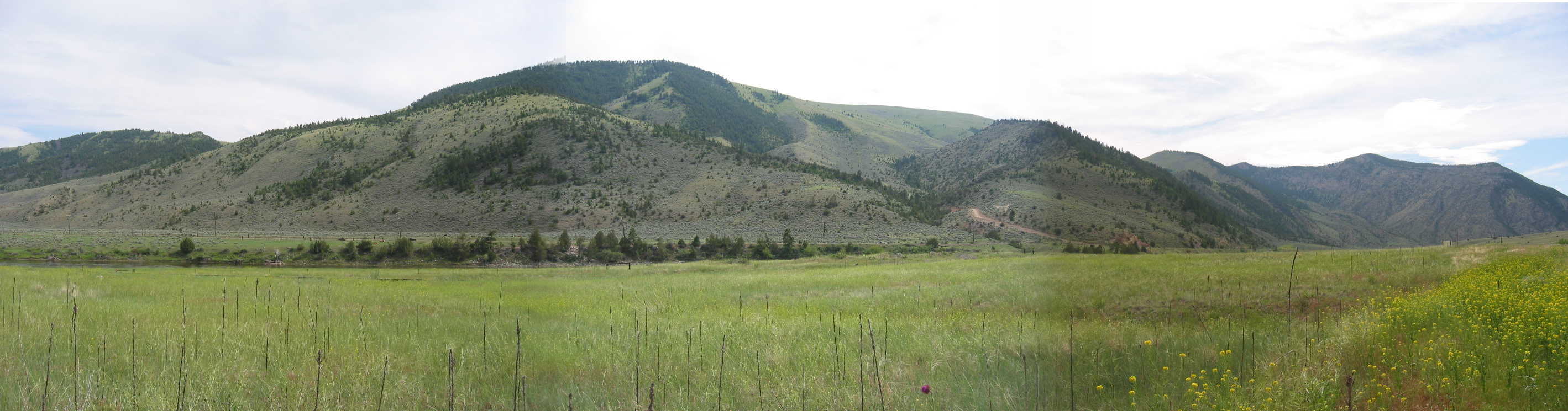
Photo Starts With A View South, Looking At The Jefferson River And The Valley Landscape Beyond:
..ClickDrag Bar, Gradually Scroll This Panorama, To The Far Right. Now You Are Looking West, Away From Three Forks, MT And Towards Up River.
At Right Photo Edge, You Can See A Tiny Bit Of The Highway, And ALSO Flowers. These Flowrs Should Remind You Of The Highway Edge Flowers, Seen In The Previous Panorama.
.[the road] [
. cuts into a narrow canyon of whitish-tan rock, past some Lewis and Clark caves.
]
Along The Jefferson River, Approaching . A Narrow Canyon Of Whitish-Tan Rock ~2 Miles SE Of, Jefferson Island, MT. ..
..****************..
SIDE NOTE => In ZMM, After Typically ~2.5 Pages of Chautauqua Discussion, The ZMM Narrator Will Make An Abrupt Switch FROM Chautauqua Discussion TO The Travel Narrative Description: And When This Happens, Author Robert Pirsig Will Write Into ZMM =>
.Travel Narrative Details Such As The Travelers Arrival At The Next Named Town + Some New Scenery. AND nearly Always, Author Pirsig Works In, Poetic/Metaphoric Bridge Connections , Between 1) The Travel Narrative Description, and 2) The Travel Narrative Descriptions, As Has Been Discussed In Previous Photos.
.This is because he discovers and works into the story => How the travel conditions relate metaphorically / poetically to the current Chautauqua Lecture.
.However, in the travel from Three Forks, MT to Hall, MT apparently no such connections were found or invented by the Narrator. Although there may be other additional reasons, the Narrator mentions no town name here in the Jefferson Island area. Perhaps the Poincaré topic is too important to withstand an interruption for scenery or anything else.
.There must be powerful reasons, because after Hall, MT, the Narrator again (in continuing the Poincare Chautauqua) fails to mention when he and Chris get back on the highway. To my recollection, this is the only place where this kind of story discontinuity takes place.
.****************..
NOTE: The FOURTH Next Photo Showing => A High Walled Canyon Near, Jefferson Island, MT. =>, Has A Link To => A Google Satellite View that is CLOSER-IN on this photo location (Red Pinpoint) where => The Canyon Is So Narrow, the Road Is Jam Tight Against The High Cliff. This is on Rt-2 , by Jefferson River near Jefferson Island, MT. This photo hasadditional extensive explanations. What You Need To Know around this area of the Jefferson River.
..****************..
A Note To Prepare The Reader (You) For The Next 23 Photos To Come:
.Just prior to Three Forks, MT, the Narrator, after introducing Poincaré, finishes his 4.5 page Chautauqua on the Three Geometries. Then, per normal practice before he returns to Poincaré, he introduces a half page of Travel Narrative Scenery,which follows the ZMM Passage Italic above =>
East of Butte we go up a long hard grade, cross the Continental Divide, then go down into a valley. Later we pass the great stack of the Anaconda smelter, turn into the town of Anaconda and find a good restaurant with steak and coffee. We go up a long grade that leads to a lake surrounded by pine forests and past some fishermen who push a small boat into the water. Then the road winds down again through the pine forest, and I see by the angle of the sun that the morning is almost ended.
....We pass through Phillipsburg and are off into valley meadows. The head wind becomes more gusty here, so I slow down to fifty-five to lessen it a little. We go through Maxville and by the time we reach Hall are badly in need of a rest. ..
.But this ZMM Narrative is anything but normal! As you will see in next 24 Photos =>
This half page of ZMM Travel narrative, encompasses => An immense range of scenery, ten towns, 110 miles of travel.
.For me (Henry Gurr ZMM Route Researcher), this ZMM half page, used 8 hours travel & research, during which I took 65 photos and 12 pages of paper notes single spaced.
.I wont tell you how long it takes me get this same part of my research trip, prepared and uploaded to ZMMQ Gallery, but it well exceeds by five, my corresponding road travel time!
.All of this the Narrator covers in a half page of text!!!
..****************..
SIDE NOTE:
. The Previous Photo, The /\ Above /\ Photo and the Next Photos (Each A Stitched Composite of 3 Individual Photos) are all taken at the Same Place along The Jefferson River, which here by happenstance is Flowing East toward Three Forks, MT. .
But Please Remember that the Subsequent 2 Photos showing the Canyon Is So Narrow, the Road Is Jam Tight Against The High Cliff, The river there is flowing ~South.
*************************
(Photo = 109-0928 +108-0929 + 109-0930sc ...... ZMM Page = 235 ...... WayPt = 232x 4308ft)
