ContFmPreviousPhoto =>
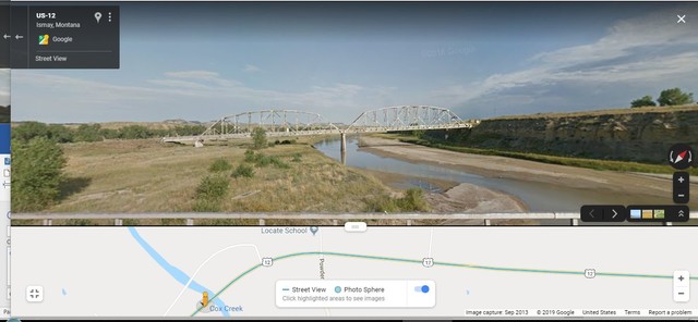
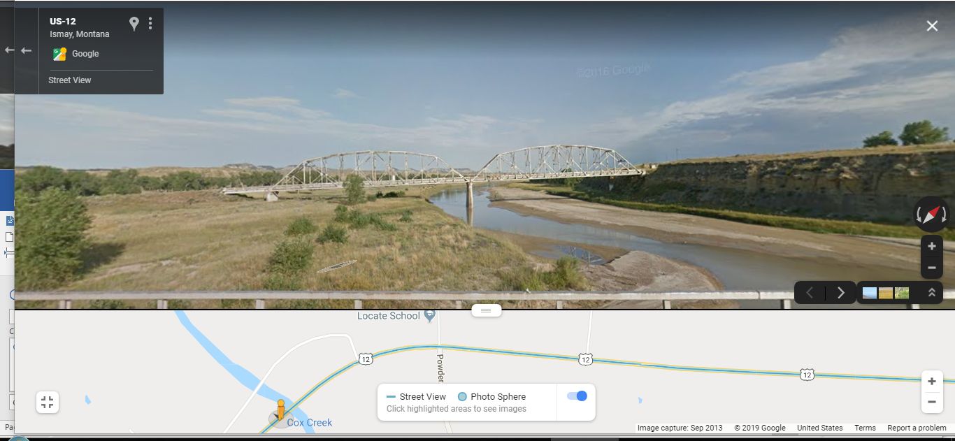
The Old Truss Bridge & The Powder River, That Was Mentioned In The Sign, of Previous Photo: (AND ChangesSinceRobertPirsig1968Trip),
From this vantage point (View /\ Above /\), you can appreciate how the old and new stretches of US 12, created a nice River Trees Nature Walk between them!!
. Remembering to click photo several ties to get the biggest view, & possibly use Magnifying Glass. => In In the GSV Strip Map /\ Above /\, look close above the shown US 12 and you can see in Weak White Line, the Old US 12, going over the Old Truss Bridge.
.AND ~Twelve Miles East (perhaps Mile Post 43.6) is the approximate location of ZMM Book The US 12 Roadside Stop, Locate / Plevna, MT, THE TOPIC OF NEXT PHOTO.
Henry Gurrs camera failed for last 30 miles, including this Truss Bridge Scene, but this Google Street View Is better, since it => In addition to 360 deg Full Circle Panorama,. it offers you ability to GSV drive and see more Eastern Montana Landscape on down the road! Click Here.
AND If you keep GSV Driving, 12 Miles East, you will be able to experience the ZMM Route, further East, including the ZMM Book Road Side Rest Area, at Locate MT..
Here Is What The ZMM Narrator Says About Their 1968 Stop At ZMM Roadside Rest Area, ~ 12 Miles East On US 12, and SHOWN NEXT PHOTO.
We enter a low-rimmed canyon. Before long, a roadside stop Ive been waiting for appears. A few benches, a little building and some tiny green trees with hoses running to their bases.
.**************
.
Here You Should Realize That The Narrators We Enter A Low Rimed Canyon MEANS => The Canyon of This Powder River Here /\ Above /\ Seen! ((And Click Here To See A GSV Overview of The Powder River Canyon, Plus The Forested Major Ridge On Distant Horizon. This is where previous Photos Mentioned Main Ridge Road, and the ZMM Narrators Description =>
."I think we have arrived," John says. ))
Cont Next.Photo => A PANORAMA VIEW Of => The US 12 A Roadside Stop Mentioned in ZMM.
.********************
.
SIDE NOTE: For more discussion of Eastern Montanas Powder River Scenic Country, And See A Panorama Of Illustrating This Land, Plus a Related Satellite View => Click Here => And AFTER This Gallery Listing Comes Up => Study The 9th & 10th Small Photo, ESPECIALLY Where Discussing => Powder River ALSO See 12th Small Photo, Showing More Eastern Montana Dry Lands .
Photo File = GoogStVu IsmayMT TrussBridgOverPowderRvr(CoxCreek)NearLocateSchool.jpg
Posted 12 Junet 2020. Revised 13 Oct & 19 & 27 Oct & 5 Nov & 21 Nov 2020.