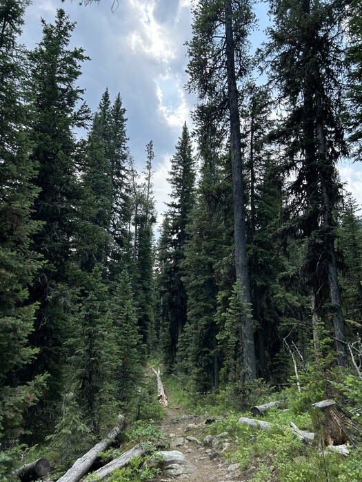
The Mountain Climb Continues Easy, And Follows A Well-Traveled Level Forest Path:
And You Will Have To Imagine Cottonwood Creek, Is On The Left.
.Occasionally the trail opens into a patch of sunlight and grass that edges the canyon stream, but soon it reenters the deep shade of the pines. The earth of the trail is covered with a soft springy duff of pine needles. It is very quiet here.
Cottonwood Canyon, Gallatin National Forest, MT.
CONTINUED.DISCUSSION: So, Where Is The ZMM Narrator's Trail?
.Early in my search for possible mountain climb routes that fit the Narrator's Trail Descriptions, for example studied trails that =>
A) Turned off the main Cottonwood Canyon National Forest Trail, where Topo Map shows WayPt = (N+C 08 or 09 or 10) Further study shows such a route as satisfactorily leading to these above mentioned turn off would really lead thru a major canyon (Fox Creek), with a used & visible trail that fairly soon became weak, as stated by the Narrator. \
B) The trail of above A), going up the Fox Creek Canyon here, could fit these Narrator's: 1) a very steep part, 2) "flat spot/knoll, protruding from the side of the mountain., 3) cross over a "ridge", and 4) would fits the next morning's Narrative where " still have a lot of climbing to do, to reach snow.
.C) And in addition. A turn into Fox Creek Canyon this WayPt = (N+C 09), is some 5.73 miles from DeWeese's and turning up the slope at this location, would nicely fit the Narrator's time for "lunch 1/2 way up" .
..****************..
(Photo = IMG_0031 Resize1000x1333 at 12:50 ...... ZMM Page = 167 ...... WayPt = Photo Simulate N+C 02b = 1.0 mi fm DeWeese.)