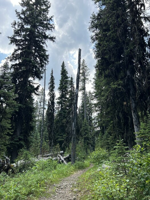
The Mountain Climb Starts Off Easy, Following A Well-Traveled Level Forest Path:
.In /\ Above /\ Photo, You Can See The Path Is On Level Ground,
And You Will Have To Imagine Cottonwood Creek, Is On The Left.
.Chris and I have had a good nights sleep and this morning have packed the backpacks carefully, and now have been going up the mountainside for about an hour. .. The forest here at the bottom of the canyon is mostly pine, with a few aspen and broad-leafed shrubs. Steep canyon walls rise way above us on both sides.
Cottonwood Canyon, Gallatin National Forest, MT.
So, Where Was The ZMM Narrator's Trail In The Mountains After He Left The DeWeese Family?
We Must Use Topo Maps And ALL The Narrator's Clues, Even TINY Ones, To Deduce His Implied Trail.
. Early in Part III, the Narrator says they => had a good nights sleep and this morning have packed the backpacks carefully. Logically, this must have been at the DeWeese's. AND since the distance to .been going up the mountainside, is unmentioned, this distance must have been fairly short. AND, since the ZMM Narrator says =>. Steep canyon walls rise way above us on both sides. , this means their path must have been in the nearby Cottonwood Creek Canyon of Gallatin National Forest.
On page 173 the Narrator says, Just up above the top of the ridge the snow can be seen now.
Since snow is mentioned several times, we may logically assume he moves, from the DeWeese home, directly towards the (closest?) snow. And show is important enough, for the ZMM Narrator to even say that, snow is visible while they are deep in this narrow canyon.
Assembling this evidence, we project that Author Pirsig wants the ZMM Reader to think of the Narrator & Chris Mountain Climb, as being (most likely) in the mountains that are Southeast of the DeWeese home.
.Indeed, as may be seen in Topo Maps, there is a 1.2 mile stretch of Cottonwood Canyon that up canyon, directly lines-up-with, some very high snow peaks, in the Gallatin National Forest, such as Mount Blackmore (10,154 feet) and Elephant Mountain (10,085 feet).
On the Cottonwood Trail, this is factually confirmed, as you will see in an upcoming photo.
.Given these crucial clues, a ridge fitting the ZMM Narrators descriptions, is also identifiable. Having thus identified a probable "ridge" on the North side of and parallel to Cottonwood Canyon, we can identify another connecting ridge, that then could lead a climber to snow. See link to map the previous photo. Indeed, as you continue to view these photos, you will eventually see 2 GoogleEarth views of this ridge. (Discussion Continued Next.)
*************************
(Photo = IMG_0030 Resize1000x1333 at 12:46 ...... ZMM Page = 167 ...... Photo Simulate N+C 02a = 0.8 mi fm DeWeese.)