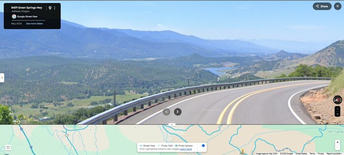
Scenery Along The Green Springs Highway OR-66. The Road Continues Its Steeper Descent Down To Schoolhouse Creek Valley, Which You See At Left.
Here, Schoolhouse Creek Flows With A Gradual Slope, Into Emigrant Creek, And Then Into Emigrant Lake, Which You See In The Distance.
It Is Likely That The Green Springs Highway, Gets Its Name From Green Springs Mountain, Which Is Some 50 Miles To The North.
And Why Green? Since Most Springs Are Surrounded By Green Vegetation, That Is Unlikely Name Source. More Likely, It Is Copper Salts Green, From Its Water Flowing Thru Copper Deposits.
ZMM Page ~317
File = GSV 8459GnSpringsHy TopoZoneSzSouthOfGrnSpringsMt OverLookSchoolhouseCreek