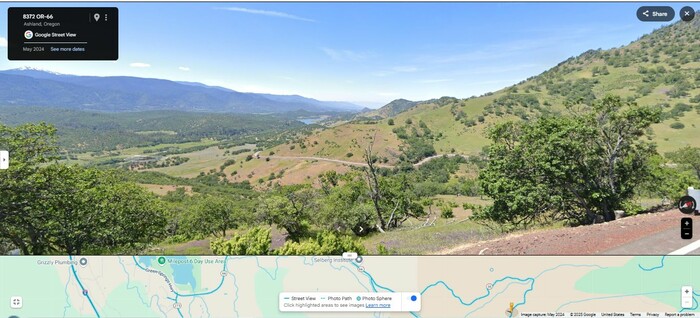
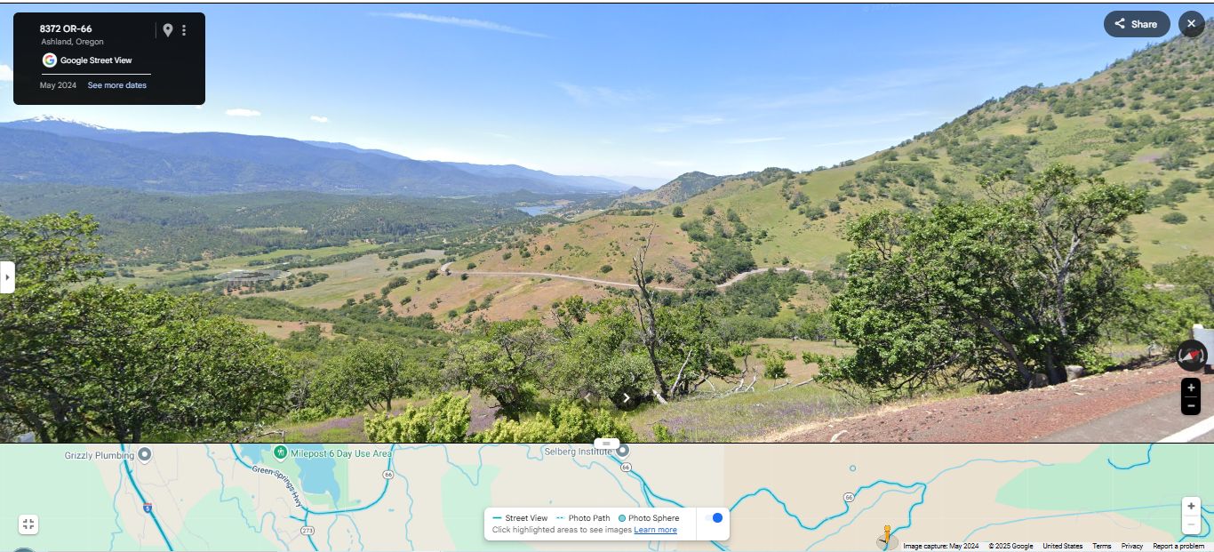
Scenery Along The Green Springs Highway OR-66. The Road Continues Its Steeper Descent Down (As Seen At Left), To Schoolhouse Creek Valley.
At Right You See How The Road Continues Down The Mountain Side.
.And Upper Left, Be Sure To Note The Snowcapped Mountain!
The Road For The Previous 100 Miles Well Fits Author Robert Pirsigs => The Road Twists And Banks And Curlecues And Descends
But, In Addition, This ABOVE Scene Best Shows Author Robert Pirsigs => A Valley That Becomes More Exquisite As We [Rapidly] Descend.
The ZMM Narrator Says =>
After a few minutes the road reaches a summit and then drops steeply into a valley that becomes more exquisite as we descend. I never thought I would call a valley thatexquisitebut theres something about this whole coastal country so different from any other mountainous region in America that it brings out the word. Here, a little farther south, is where all our good wine comes from. The hills are somehow tucked and folded differentlyexquisitely. The road twists and banks and curlecues and descends and we and the cycle smoothly roll with it, following it in a separate grace of our own, almost touching the waxen leaves of shrubs and overhanging boughs of trees. The firs and rocks of the higher country are behind us now and around us are soft hills and vines and purple and red flowers, fragrance mixed with woodsmoke up from the distant fog along the valley floor and from beyond that, unseena vague scent of ocean. . . .
..How can I love all this so much and be insane? . . .
..I dont believe it!
The mythos. The mythos is insane. Thats what he believed. The mythos that says the forms of this world are real but the Quality of this world is unreal, that is insane!
NOTE: Starting here, all along Rt-66 thru Ashland, Oregon plus 50 miles along Rt-99 Northwest of Ashland, using Google Street View , looked close for any evidence of Author Robert Pirsigs Vinyards. The ONLY place was several miles Northwest of Ashland, as you will see in a forthcoming Google Street View, screen capture.
ZMM Page 317
File = GSV 8372OR66 TopoZoneSzStGrnSpringsMt UltSnoCapMt SeeRdSteepDnSchoolhouseCreek