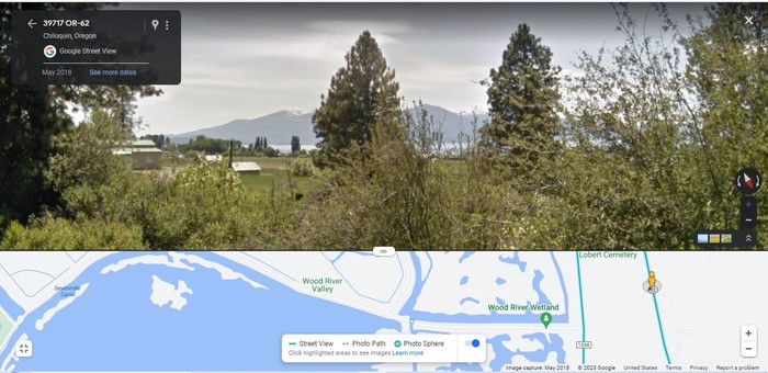
A Google Street View Shows Very Likely, What the Narrator Experienced When Going By Klamath Lake.
After Leaving The South Gate Of Crater Lake National Park, Then Turning Right (East) And Traveling Southeast On Rt-62 =>
The ZMM Route Traveler Can Catch Glimpses of Upper Klamath Lake.
And Beyond the Lake, Can Be Seen The Distant Mountains, That The ZMM Route Crosses on the way to Medford, OR and then to Grants Pass OR.
We travel down the eastern shore of Klamath Lake
. (Cont. Next)
On Crater Lake Road, Rt-62, approximately 3 miles NW of intersection of road from Crater Lake, Rt-62, with US-97, Upper Klamath Lake, OR.
EXPLANATION:
After leaving the South Gate Of Crater Lake National Park, Then Turning Right (East) And Traveling Southeast On Rt-62, the first opportunity for a meal would be Fort Klamath, OR. But this is only 11 miles and too early for midday lunch. The next practical opportunity is ~12 more miles, upon the return to civilization at the Intense High Traffic US-97.
The NEXT FOUR Photos Illustrate & Explain =>
How ZMM Route Researcher Lee Glover, Successfully Found The Rapids Café: This was the ZMM Narrators Restaurant Where =>
We pull in for lunch at a roadhouse which belongs to this era too. Wooden frame badly in need of paint, neon beer signs in the window, gravel and engine drippings for a front lawn. .. Inside, the toilet seat is cracked and the washbowl is covered with grease streaks,
.
*************************
(Photo = GoogStVu FmRt62CraterLkRd SeeKlamathLakeOR ForZmmPt4Caption.jpg..... ZMM Page = 313 ..... WayPt = 383i ~4300 ft)