Cont. From Previous Photo: A Second View In The Valley Of The East Fork Big River, Just Before The Orr Springs Road, Crosses The Bridge Over The East Fork Big River.
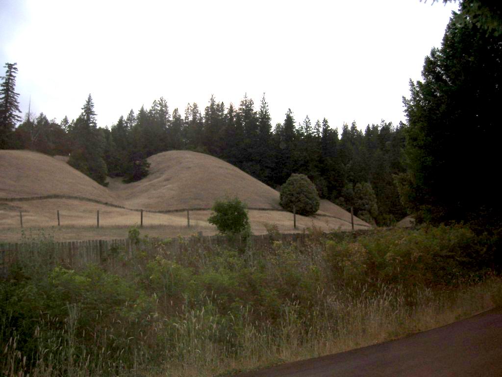
To See Where The River Is => Look Closely At The Right End Of The Fence Where It Turns Down Between The Two Tan Colored Grassy Slopes. The River Is ~200ft Further Beyond.
[ We swing into a curve and then up into the open sunlight. We swing into a curve and then up into the open sunlight. .. Thats true. I never realized it. All this time hes been staring into my back. "What do you see?" I ask. .. "Its all different." ]
We head into a grove again, and he says, "Dont you get scared?"
"No, you get used to it." (Cont Next)
************************
EAST FORK BIG (REDWOOD TREES) RIVER EXPLANATION:
.On The Previously Mentioned Comptche Ukiah Road Backcountry Road, As We Travel East Towards The ZMM Route Town Of Ukiah, CA, And After Comptche, CA =>
The Road Comes Into The Valley Of The East Fork Big River (Elevation ~600 ft):
The /\ Above /\ Photo Came Into View, After Traveling ~ 2 Miles In This Valley.
This River Was Previously Crossed Over On The Pacific Coast Highway Rt-1 South Of Mendocino CA.
In /\ Above /\ Photo the road foreground going east, just before the bridge crossing the river, 10460 Orr Springs Road, Mendocino County, CA.
..A) ~34.8 Road Miles East of Mendocino, CA and.
..B) ~9.5 Road Miles West of Ukiah, CA.
NOTE1: Although it is the same road, the Road Name Changes: Now On Orr Springs Road.
NOTE2: Please remember that => The road location of the /\ Above /\ Photo (also the previous photo), was mentioned (and illustrated) in the TopoZone Map Discussion THIRD PREVIOUS Photo. AND if you care to go back to this TopoZone Map, the /\ Above /\ Photo at WayPt = 470w 0610ft, is ON the Gridline, just below where the road is shown crossing the East Fork Big River.
************************
. RIGHT CLICK AND SELECT NEW TAB => After Satellite Map View Comes Up, You Will See ~Most Likely Choice For ZMM Route On Orr Springs Road, Some 10 Miles Running Beside The East Fork Big River. => ClickOn The Plus&Minus To Zoom. You can Click&Drag Map In Any Direction, to See More Off Your Screen Edges.
.After this Satellite View comes up (may have to ZOOM OUT to see), The Red Pinpoint marks Henry Gurrs /\ Above /\ Photo at WayPt = 470. You can see Orr Springs Road and the East Fork Big (Redwood Trees) River, which have been discussed previously, as well as forthcoming photos.
.
NOTE: WHAT ZMM READERS SHOULD KNOW CONCERNING THE LANSCAPE SURROUDING ZMM NARRATORS [ I begin to feel drowsy and in a small ravine ahead I see a turnoff and a picnic table. When we get to it I cut the engine and stop. ]
After I traveled East on the Backcountry Comptche Ukiah Road Road, the name of this road changes to Orr Springs Road and soon thereafter at some 8 miles East of Comptche, CA, I came into the valley of the so-called East Fork Of The Big (Redwood Trees) River (EFBR), where the /\ Above /\ Photo came into view, after traveling ~2 miles in this valley.
Information From Looking At The TopoZone Map (Discussion & Link THIRD PREVIOUS Photo).
After the /\ Above /\ Photo Location, it looks as though the road travels the EFBR Valley, East up stream to eventually go by the Orr Hot Springs Resort. This is where I believe Author Robert Pirsig and Chris, back in 1968, found a small ravine
and a picnic table.
************************
Concerning The Big (Redwood Trees) River Wikipedia Excerpt Says =>
The Big River is a 41.7-mile-long (67.1 km) river in Mendocino County, California, that flows from the northern California Coast Mountain Range to the Pacific Ocean at Mendocino, Mendocino County, California. From the mouth, brackish waters extend 8 miles (13 km) upstream, forming the longest undeveloped estuary in the state.
For The Complete Wikipedia Article Click Here.
After this Wikipedia Page comes up, you will see a small Terrain Relief Map of California, with a Red Dot marking where this river is. Remember this place on the coastline, then click to view this map in larger version. Look closely to find the same coast line, and then you can pick out this rivers water shed running to the South East (up river), from the ocean coast.
*************************
(Photo = 117-1729b ...... ZMM Page = 372 ...... WayPt = 470w 0610ft)
