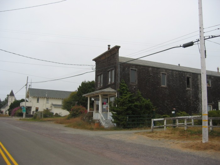
A Church, An Inn With The ZMM Restaurant, And A Print Shop Are The Small Towns Business District.
A long time later we come to a town where a luminous haze which has seemed so natural over the ocean is now seen in the streets of the town, giving them a certain aura, a hazy sunny radiance that makes everything look nostalgic, as if remembered from years before. (Cont Next)
Business area, Caspar, CA.
*************************
Excerpts from => DESCRIPTIONS AND POLICIES FOR THIRTEEN PLANNING AREAS SOUTH CENTRAL CAC PLANNING AREA. Sec 4.6: JUG HANDLE CREEK TO RUSSIAN GULCH PLANNING AREA (Includes Caspar).
Caspar is a former lumber mill town, situated on a coastal terrace that at one time was also planted in some vegetable crops. The land slopes gently to sharp bluffs, interrupted only at the creek mouths. The planning area's vegetation includes the southernmost Sitka Spruce forest, windbreak planting, mixed fir and redwood forest, pygmy forest, scrub, Scotch Broom and gorse. After operating from 1861 until 1955, the lumber mill is now gone, its former location marked only by the mill pond weir, a few remaining workers' cottages, and buildings in the village. However, the Caspar Lumber Company still owns 300 acres on both sides of Caspar Creek, the future use of which will be the single most important determinant of community character.
Highway 1 is a two-lane expressway through Caspar and offers views of grazing lands fronting the old town and occasional distant views of the ocean. Old Highway 1, renamed Point Cabrillo Drive between Caspar Creek and Russian Gulch, provides one of the coast's rare alternatives to Highway 1 for intra-community travel. A gap in Point Cabrillo Drive at Caspar Creek, where all vehicular traffic must use the expressway, limits the sense of community and the potential for commercial development in Caspar.
Later sections of the document mention how to locate various trails/drives plus scenic attractions, including a lighthouse.
Later passages say you can follow the =>
A) Old Highway 1 through Caspar to Doyle Creek: [This] Trail follows existing road (County Road 569), then unimproved trail along headlands to beach.
B) Point Cabrillo Alternative Coastal Trai l Location: Point Cabrillo Drive (Old Highway 1 now County Road 564) from Caspar Creek to Russian Gulch.
C) Existing Development: Pedestrian, bicycle, and equestrian use; connects with alternative coastal trail along Point Cabrillo Drive (Old Highway 1) to west; and also connects to Little Lake-Sherwood Inland Trail; designated by County Trails Plan.
D) Point Cabrillo Alternative Coastal Trail: Location: Point Cabrillo Drive (Old Highway 1 now County Road 564) from Caspar Creek to Russian Gulch.
. (End excerpts.)
Click Here For The Complete THIRTEEN PLANNING AREAS Document.
*************************
(Photo = 117-1702 ...... ZMM Page = 364 .... WayPt = 462w 0099ft)