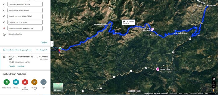
A Satellite View Of Significant Places In The So Named Lolo Trail, Where The Red PinPoint Marks The Indian Postoffice.
But Be Aware That What Is Shown In Blue, Is Only A Small Portion Of The Traditional Lolo Trail, Which Runs From Oregon To Buffalo Country On The North American Planes.
Please Remember, Since The Photos That Follow Discuss Places Shown On This Satellite View.
Also, Please Remember, The PREVIOUS Photos That Has A COMPLETE Lolo Corridor Visitors Guide
With Tips for Driving Elk Meadows Road in Lolo National Forest. =>
File = SaVu LoloPass.RocheyPoint.PowelJt.EastPortLoloMotorWay.CayuseJt.IndianPostoffice
Click Here For A Satellite View Of This Location.