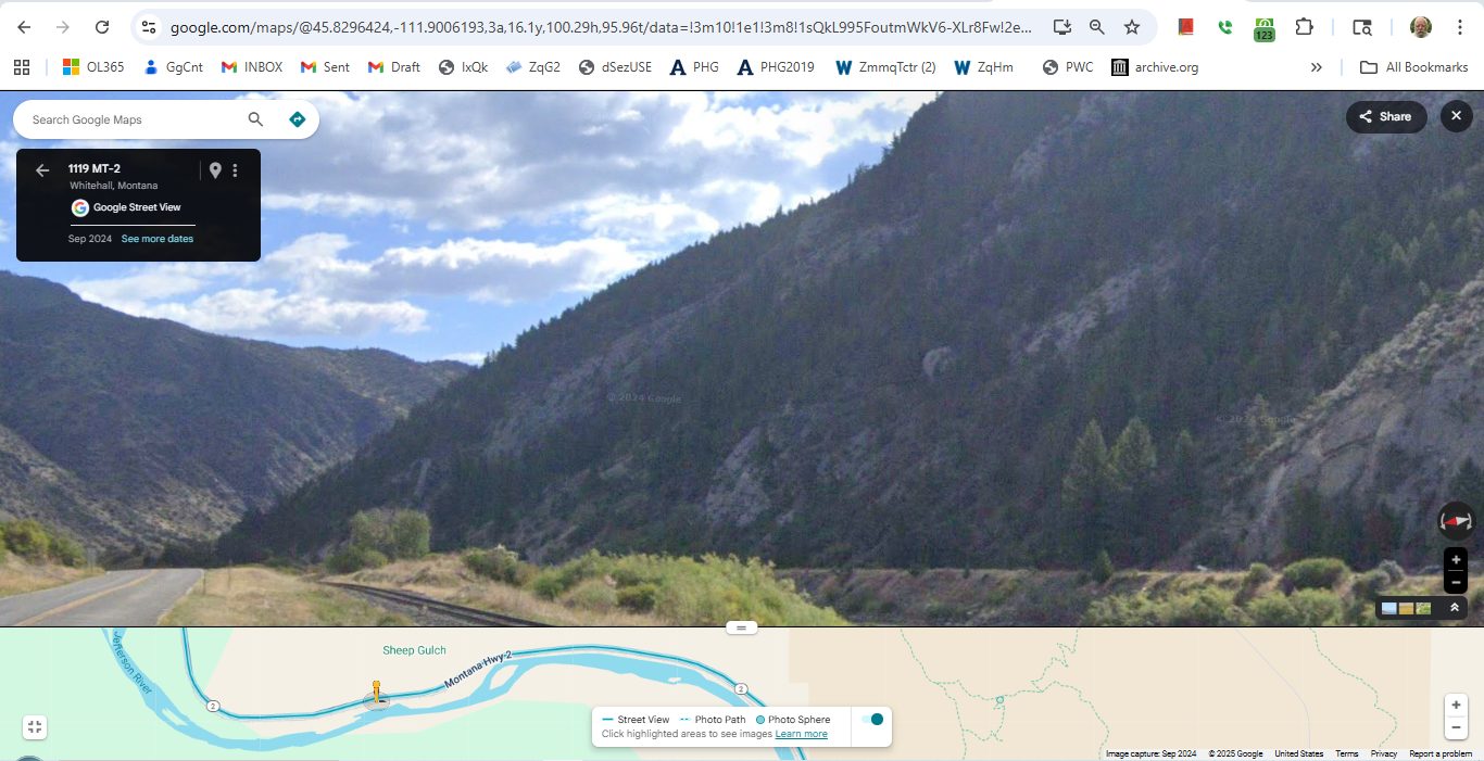
Added July 2024 => A Google Srteet View, Adjusted To Shows The Scene Of Previous Photo Called => A Great, Indeed Dramatic, Water Edge View Of The Deep Narrow Canyon, Cut By The Jefferson River.
You Can See How The River, Highway, Railroad & Dirt Road, Are All Jammed Tight Into The Canyon!! GPS = 45.8296424,-111.9006193
NOTE1: The /\Above/\ Google Srteet View (GSV) was found by first guessing where this Jefferson River Scene might be, using fact that it is in a very deep narrow rocky canyon.
Then by Click-Jumps GSV Drive ahead until a good fit is found.
And, once found, the GSV strip map can be compared to a Satellite View, to determine the GPS Coordinates.
NOTE2: On the previous Satellite View Map, this GPS location is a bit East of where labeled 0501.
File = GrtVuJeffersoRiverCanyon..cardwell 107 ScrnCpt ExtvGsvDriveFindsVeryCloseEqualVu.jpg
Click Here To Go To A Google Street View, That Shows The Scene in The /\Above/\ Photo, At This Location. You Can Then ClickDrag, Explore On Your Own.
