Friday, July 19, 2024:
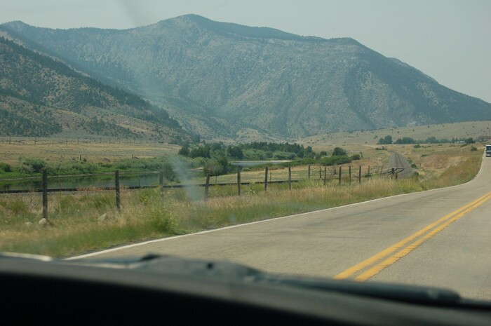
Traveling Montana Rt-2, We See A Typical View Of How The Jefferson River Fits Into The Folds Of The Mountains.
You Can Also See The Water Of The Jefferson River And The Vegetation At The River Banks. To Left Of The Truck, Look Closely To See The Railroad Tracks, Which Continue All The Way To Left Edge Of Photo. GPS = 45.8212236 -111.8330167
NOTE1: a) The Jefferson River flow is greatest during a 4-6 week snow melt-off, about mid-May to mid-June. b) One Fishing WebPage says of this river => The current is usually slow, and irrigation can literally takes a heavy toll on water levels [especially] during drought periods. c) My (Henry Gurr) Photos are about June 24, and thus are well after the higher river flows. d) The Lewis and Clark Expedition, the first several days of August 1805, would have seen the river at its lower flow. But the river flow they experienced, could have been considerably greater than the present day, because of no irrigation back then.
NOTE2::The Satellite View mentioned below shows => What is at ground level for the location of Red Pinpoint, marking where the Jefferson River makes its deepest-narrow-cut-throughs in this mountain ridge.
..****************..
Continued Topic => Where Can We Observe Whitewater Or Rapids, Along The Jefferson River?
.My 2002 ZMM Field Research along the Jefferson River, was done before I knew river rapids were important: Thus my 8 photos, were taken without any attempt to show rapids. What river water my 2002 photos showed, by happenstance, calm water, except for my 2 photos taken within the Very Steep Walled, Narrow Canyon.
Of course, what appears as possibly rapids, may be simply due to the sharp curve of the river making disturbed surface, rather than show a river water speed where are found true rapids. In some of these photos, the water surface shows NO rapids, but only looks slightly disturbed by light wind.
.
. In a Satellite View, One of The Better Places Where Is Seen The Slight Streaky Whiteness of Whitewater, and Thus Evidence Of Lewis & Clarks Difficult Rapids => Seen Above Word Google At Bottom Center. Click Here. This particular place in the river is especially narrow water, AND a more than ever, sharp turn! Click Here.
.CAUTION: In this Satellite View, Sand or Sandbars are White Or Whitish. The Whiteness that shows rapids happens to appear as Greenish Whiteness. You will have to study this closely and carefully to See And Understand What You See!!
File = DSC_0494 Resize1504x1000 ~154KB
Click Here To Go To A Google Street View, That Shows The Scene in The /\Above/\ Photo, At This Location. You Can Then ClickDrag, Explore On Your Own.