There Are Many Routes Into the Mountains, Real and Philosophic.
.Some travel into the mountains accompanied by experienced guides who know the best and least dangerous routes by which they arrive at their destination. Still others, inexperienced and untrusting, attempt to make their own routes. Few of these are successful, but occasionally some, by sheer will and luck and grace, do make it. Once there they become more aware than any of the others that theres no single or fixed number of routes. There are as many routes as there are individual souls.
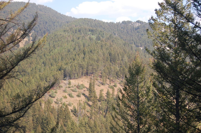
Upper Cottonwood Canyon, Gallatin National Forest, MT. (Continued fm previous.) As a person reads ZMM => At first the Narrator's climb routes physical layout, may be a complete mental scramble.
.But as we study a topo map and read and re-read Chris and Narrators climb (Chapters 16-21), we can begin to see a route that fits rather well the Narrators overall clues
And as you will see => My "N+C Hypothetical Climb Trail" is indeed a route an experienced mountaineer would choose as a reasonable way to climb to the snow with an 11 year old boy.
.So, Where Is The Narrator's Trail?
.Early in my search for possible mountain climb routes that fit the Narrator's Trail Descriptions, I studied trails that => Turned left off the main Cottonwood Canyon National Forest Trail where Topo Map shows WayPt = (N+C 05 or 06) =>
.Going up the canyon-side here, would fit these Narrator's: 1) a very steep part, 2) "flat spot/knoll, protruding from the side of the mountain., 3) cross over a "ridge", and 4) would fits the next morning's Narrative where " still have a lot of climbing to do, to reach snow.
.But further study shows such a route as unsatisfactory. For example, these above mentioned (N+C 05 or 06) route would NOT really lead thru a major canyon with a used & visible trail, as is implied by the Narrator. Also this WayPt = (N+C 05 or 06), are some 2.23 or 3.43 miles from DeWeese's and turning up the slope here, would put the Narrator's time for "lunch 1/2 way up" too soon.
.Despite this, you will see on my Topo Map Photos, two alternate climb routes: (N+C 50 to 61) and (N+C 69 to 96). These with important exceptions, are alternates, that have many successful fits to the Narrator's descriptions.
..****************.
. However, For Now Lets Focus On A N+C Hypothetical Climb Trail, That Somewhat Fits The ZMM Narrative. The Following Discussion Applies To This Topo Map, That Is The Topo To Focus On. Right Click and Choose New Tab.
..A) WayPt = N+C 01 to 07 are IN Cottonwood Canyon, going from DeWeese Home to nearly a left turn into a Mountain Side Gulch.
..B) Between WayPt = N+C 07 & 09 you will see a whole series of close WayPoints:
..C) THESE MARK A MEDIUM GOOD =>:N+C Hypothetical Trail, going up an UN-Named gully, from WayPt = N+C 08 & N+C 71 (hard to read), which is a steep part up to N+C 77 then not so steep to N+C.79
..D) Continue following the series of close WayPoints to WayPt = N+C 80. This marks the climb to a knoll for Narrator & Chris overnight camping.
..F) WayPt = N+C 80.to 88 marks the climb to a Mountain Top, where Chris shouts Blue Sky!
..G) WayPt = N+C 88.to 96 mark Narrators (frightened rock-slide) climb down to a nearest road in Hyalite Canyon. I have chosen a way that goes through a narrow muddy cut.
..****************..
. However, AN EVEN BETTER => N+C Hypothetical Trail, That Has A BEST Fit To The ZMM Narrative. The Following Discussion Applies To This Topo Map, Which Is The One To Now Focus On => Right Click and Choose New Tab, Where Will See => The following Marked Trail =>
..H) WayPt = N+C 01 to 08 are IN Cottonwood Canyon, going from DeWeese Home, to nearly Fox Creek Canyon.
..I) .WayPt = N+C 09 & 10 are further up-stream Cottonwood Canyon, and MARK THE. Continuation of => A N+C Hypothetical Climb Trail, into Fox Creek Canyon. This trail leaves Cottonwood Canyon to go East, Then Southeast, to go up, at first close by Fox Creek WayPt = N+C 10 & 11, then gets gradually steeper. Continue very steep to West of the creek, to climb towards WayPt = N+C 12.
..J) WayPt = N+C 12 leads to a nice climb to an adjacent knoll for Narrator & Chris overnight camping.
..K) Continue next day along Fox Creek to WayPt = N+C 14, which marks a steeper climb. Then after (possibly) a zig-zag, the climb turns Southeast going by WayPt = N+C 15. Then climb to a ridge top WayPt = N+C 23 & 24, where Chris shouts Blue Sky!
..L) Follow ridge South towards Mount Blackmore, where Google Earth shows patches of snow.
.M) WayPt = N+C 25, 26,27 28, marks Narrators (frightened rock-slide) climb down to a nearest paved road, and Trailhead Parking Lot where there would be people for Narrator & Chris to hitch a ride back to Bozeman. This is at WayPt = N+C 29. I have chosen a way that goes through a muddy rut at Blackmore Creek.
..N) Alternatively, after WayPt = N+C 25, a perhaps easier route could be found Northeast to nearest NF Dirt Road.
..****************..
. ATTENTION => All Mountain Climbers, Hiking Clubs, And Boy Scouts, Are Hereby Invited To Help Confirm This => "N+C Hypothetical Climb Trail " WayPt = (N+C ##) => Please study the discussed "N+C Hypothetical Climb Trail " (N+C ##) given in the previous captions. Then please contact me for what Volunteers Can Help With.
.SAFETY FIRST: Be sure to a) Take your Bear Spray and b) Tell Other People or National Forest Service Where You Are Going, So They Can Come Looking For You, In Case You Do Not Come Back At A Scheduled Time!
*************************
(Photo September2006 0165 ...... ZMM Page = 167 ...... Photo Simulate WayPt = N+C 04 = 1.68 mi fm DeWeese.)