The Narrator and Chris Work Off Anger & Resentment, As They Move Slowly Upward For the Next Hour.
.They Find What Seems To Be the Last Available Water.
. He shows anger, but says nothing, for fear hell have to carry the pack again, just frowns and ignores me while I relay the packs upward. I work off the resentment at having to do this by realizing that it isnt any more work for me, actually, than the other way. Its more work in terms of reaching the top of the mountain, but thats only the nominal goal. In terms of the real goal, putting in good minutes, one after the other, it comes out the same; in fact, better. We climb slowly upward and the resentment leaves.
.... For the next hour we move slowly upward, I carrying the packs in relays, to where I locate the beginning trickle of a stream. I send Chris down for water in one of the pans, which he gets. When he comes back he says, "Why are we stopping here? Lets keep going."
... "This is probably the last stream well see for a long time, Chris, and Im tired."
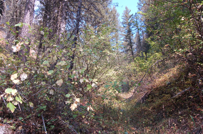
Up the side of Fox Creek Canyon, A Smaller Canyon, Off Of Upper Cottonwood Canyon, Gallatin National Forest, MT. Several days later Chris has diarrhea. Is this from drinking stream water in these mountains?
.MORE TRAIL CLUES:
..a) An hour more they move up steadily. This implies a continuation of the same grade since near the beginning at Fox Creek.
..b) They find a trickle of a stream small enough such that this is likely the last water. According to the Topo Map's blue color, Fox Creek is a stream here, and even much farther up. This would imply more than just a trickle of water. However, this is a low area, wind sheltered and a South facing slope. Despite the forest, this would promote more rapid drying, thus any water this far up, might have nearly have dried up in the mid-summer when Chris and the Narrator were there.
..c) Alternatively the Narrator may have found a hillside spring & small stream, perhaps some distance from Fox Creek, depending on their route up.
.My "N+C Hypothetical Climb Trail ", marked on my Topo Map, assumes the trail goes close by Fox Creek where there might be water, then goes West from the creek, and continue up to towards base of the ridge ahead, climb onto it, & there are close to a knoll for camping.
.This trail assumes Narrator & Chris have climbed the continuing grade somewhat along Fox Creek (or not too far away) this entire climb.
.Determination of the presence (or absence) of Summer time availability of water in Fox Creek and how far up, will have to await an additional trail research.
*************************
(Photo = September 2006 0146 ...... ZMM Page = 197 ...... Photo Simulate WayPt = N+C 11 ~7200ft = 6.56 mi fm DeWeese.)