The Clouds Appearing On the Other Side of the Canyon, Signal Problems With Chris.
.Also Metaphorically Indicates Problems With The Narrators Working Out An Understanding of Quality.
.The New Coolness Makes It Easier Hiking AND Easier Discussion of Quality.
. "I dont like this trip," he says. "It isnt any fun. I thought it was going to be fun." .. Some anger catches me off guard too. "That may be true," I reply, "but its a hell of a thing to say." .. I see a sudden flick of fear in his eyes as he gets up.
.... We go on.
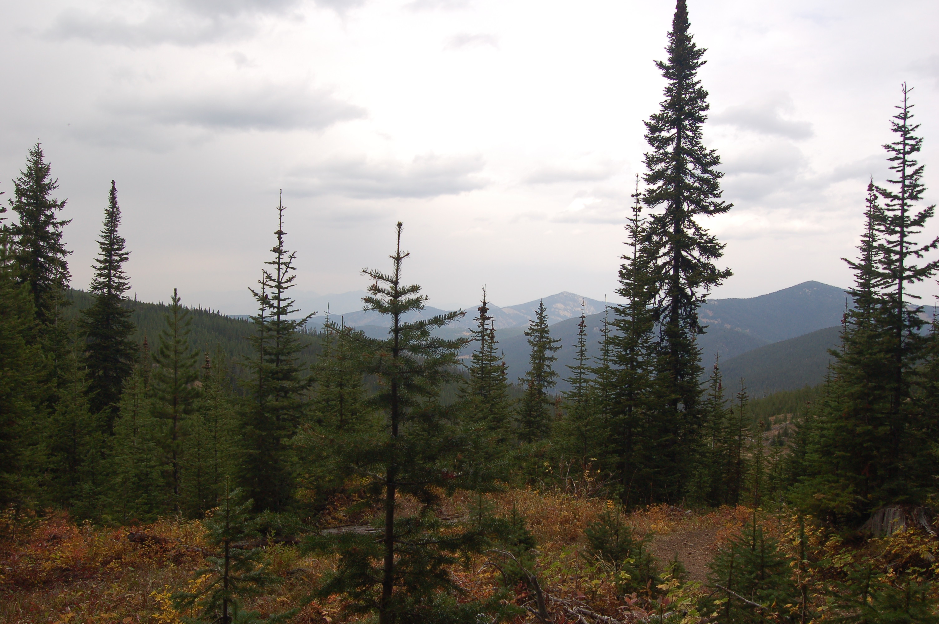
.... The sky over the other wall of the canyon has become overcast, and the wind in the pines around us has become cool and ominous.
.... At least the coolness makes it easier hiking -- . ..
Climbing the side of Fox Creek Canyon, Gallatin National Forest, MT. (GPS = 45.47608 -111.02714 ) Note how the Narrator's clouds warn us of bad things to come, and this is not necessarily the weather! This keeps the reader in suspense, and is one of the Narrator's techniques to keep the reader alert and engaged!
..****************..
. Click here for Google Maps Satellite Overview of Cottonwood Canyon, Fox Creek Canyon, showing => A Trail Partly Following Fox Creek. Unmarked Center of screen is WayPt = N+C 12.
.AFTER Satellite View Comes Up, ,ClickDtag gradually to South and a bit East, and will See at Right } Hyalite Reservoir, then Hyalite Creek Trailhead. Continued ClickDrag South you will see to center and more left => Mount Blackmore and Elephant Mountain.
..****************..
SIDE NOTES:
.
.Free Download For A Computer APP You Might Want To Use =>
..Google Earth Will Show ~SAME Satellite Views (As Above Blue Link), But With Many ADDED VIRTUES !!
.Once GoogleEarth comes up on your computer screen (just like Google Map Satellite View), you can either search or ClickDrag, to find what you are looking for, such as Bozeman MT or A Ridge At Mount Blackmore's West Flank!
.A) An especially nice feature => The GoogleEarth Display somewhat reveals the 3D.View of These Mountains, by manually doing a Clk&Drag of the landscape!
..B) GoogleEarth, is One Of The Best (And Free) GPS Data > Map Display APPS,
..C) AND The Internet Download and Install of this Computer Application, is relatively easy and reliable.
..D) Once GoogleEarth, is installed in a persons computer, they can Import the GPS Coordinates, from their Handheld GPS Unit.
..E) Once a persons GPS Coordinates are imported, GoogleEarth does an excellent job of display of these GPS WayPoints, added to the Mountain Terrain View !!
..F) AND there are many other Tools, Adds: and Map Layers plus => Many other nice features, that you will eventually want and use!
..G) GoogleEarth > Tools > Ruler > Can give you point to point (straight line) travel distances in miles. This is an especially useful.
. Heres What You Have To Do =>
GoogleEarth > Top > Tools, where you can select Ruler, which in turn allows you to mouse-click-mark two points on your Trail View.
. With more clicks you get the point to point (straight line), travel distance miles, which are (straight line), shown on your trail map.
.AND you can save successive such straight lines to show a map of a complete Mountain Climb, all of which is added to the (somewhat) 3D.View of These Mountains. Naturally the 3D.View includes the Satellite Image, which shows the trees, rocks, streams, rivers, roads, & towns!
.****************..
Henry Gurrs Steps =>To Learn How I Use GoogleEarth => Right Click & Open In A New Tab.
.Then AFTER this Photo Comes Up => Start reading at
. For Persons Who Which To Know More =>
For the above you must (free) download and installed in your computer
. Great Views. Try It! It Is Easy, Comes Up Quickly And Is Lots Of Fun!
******************
.
. Google Maps & Satellite Views, Can ALSO Give You Point To Point Travel Distances In Miles ALONG THE ROAD (But Only On Official Roads). =>
.However Using This Feature, Is Hard To Figure Out, Unless You Have A Working Example!!
.Heres A Working Example & What You Have To Do =>
Right Click & Open In New Tab. After this Satellite Map Comes up substitute YOUR OWN TWO ADDRESS for those in two lines upper left, then click on Search Symbol. You can then save the map with road shown & distance shown.
******************..
(Photo = September 2006 0050 ...... ZMM Page = 193 ...... Photo Simulate WayPt = N+C 10ii 6900ft = 5.95+0.4 mi fm DeWeese.)
