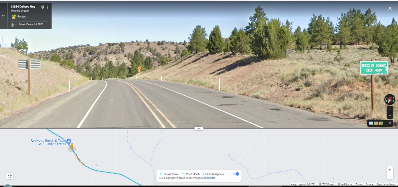
Surrounded By Lots Of The ZMM Narrators Dry Hills, At Right The Sign Says => Keyes Creek Summit Elevation 4369 .,
.Here We See Typical Central Oregon Wide Open Countryside That Is Hot Dry Country Were Going Through.
[ This motorcycle seems to be running a little hot . . . but I suppose its just the hot dry country were going through ]
Keyes Creek Summit Pass, OR.
After turning West from Rt-19 Junction, at John Day River, US-26 climbs steadily up along a tree-lined stream into dry hills at Keyes Creek Summit Pass (4,369 ft).
.And although the ZMM Narrator omits mention of some 32 miles of travel from Dayville, OR to the next town of Mitchell, OR, I have added the /\ Above /\ Photo, and 1 more, to show the scenery along the way..
From Here To Mitchel, OR: It Will Take ~25 Minutes For You To GSV Drive To See The Really Deep & Rugged Road Cut Scenery (And One Scenic Vista), ~10 Miles Along The Way =>
. Right Click & Select New Tab. And AFTER this GSV Comes Up => You Will See That This Google Street View (GSV) Has Many Advantages, Since => In Addition To A 360 Deg Full Circle Panorama View, You Can => A) Look Farther Up AND Down, Plus B) Offers Ability To Zoom Magnify And See Better Details, Such As What A Distant Sign Says.
.INSTRUCTIONS =>After Google Street View (GSV) Comes Up, Then => Click The Google Street View Image, WHERE You Want The VIEW To Go. => Thus You Can Successively Click-Click-Click & GSV Drive Along The Street You See On Your Computer Screen. You Can Even Click-On A Side Street, To GSV Drive Along That Side Street !!
.HINT: For Each Click To Go The Greatest Distance, Click On The Road The Furthest Distance Away.
.FOR EXAMPLE, AFTER GSV IS ON YOUR SCREEN => You could GSV Drive => 1) Down US-26, several miles to see Scenic Overview of Keyes Creek Valley, OR 2) GSV Drive Along US-26, ~ 10 miles forward, To Experience The Ochoco Highways Really Deep, Dry, Rugged Road Cuts.
. At any time, you can Click-On the Plus&Minus to Zoom
. AND You can ClickDrag the Image On Screen in any direction, for a better view.
********************
(Photo = CurveDown+GrnSign GsvUS-26 KeyesCreekSummit4369ft 21884OchocoHwyMitchellOR.jpg...... ZMM Page = 290 ...... WayPt = 344j 4369ft)
