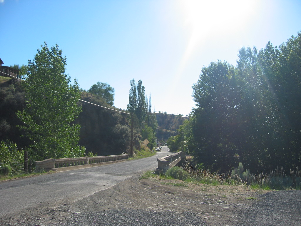
Looking West, We See What Was The Original Highway, That Here Went Over This Bridge, Straight Into Business District, Mitchell, OR.
.This Is The Turn-Off From The Newer Town Bypass Highway US-26, Onto Main Street,
.The South Wall Of This Rocky Gorge Itself Is Discerned Upper Left, Above Left Side of Bridge, And Also Above The Street In The Distance.
.We stop for a long chocolate malted in the town of Mitchell, nestled in some dry hills
. (Cont.Next)
The Turnoff Into Mitchell, OR. Judging from the ZMM Narrators statements (in previous photos at Dayville) concerning his & Chriss midafternoon resting in grass of Dayville, we can assume that they came through here about the time of day, that is shown by the late afternoon low angle of the western sun as appears in /\ Above /\ Photo.
..****************..
Why Do All But One Of The Previous Seven Photos Show Barren, Baked And Lifeless Central Oregon Desert, Whereas This /\ Above /\ Scene Shows Plentiful Green Trees And Grass?
.This is because the road coming here, went down into the deep gorge of Keyes Creek, were the ZMM Traveler finds Mitchell is nested. And all the green grass and trees here get moisture from Keyes Creek, an all summer running stream that goes under the bridge.
.The THIRD Photo Next will show these dry hills, and how this town is tucked into the slopes of a deep gorge..
..**************** .
Interesting Historical Photos Of Mitchell, OR, From => Historic Resources Study (Chapter 5), Provided By The John Day Fossil Beds National Monument:
1) Photo "Fig. 36. "City Hotel and Harness Shop" at Mitchell"
2) Photo "Fig. 37. Sidewalk Café (circa. 1945) in Mitchell." and the appearance of the building practically unchanged up to my, Henry Gurr, photo of 2002.[However, this photo shows a ~1968 Chevrolet Pickup Truck, and thus must been taken after 1968.]
.EXPLANATION: As you will see & learn in Next Photo, The Sidewalk Café is most likely the ZMM Restaurant where the Narrator & Chris =>
stop for a long chocolate malted in the town of Mitchell, nestled in some dry hills
.
Right Click And Select New Tab. AFTER This Page Comes Up You Will See Above-Mentioned Photos.
.ALSO, AFTER the Above-Mentioned Page Comes Up => At the BOTTOM of the Page, You Will See Previous and Next.=> These Will Take You To A VAST STOREHOUSE Of Historical Photos & History, Similar To What You Already See!
.In Fact, A Click On Previous Will Show A ~1930 Photo Of Main Street Dayville, OR, A View Showing ~4 Commercial Buildings, Where This Albums Previous 2002 Dayville, OR Photos, Showed Gas Stations.
.The Pages of This Historic Resources Study several times mention the Old Dalles-Boise Military Road. This road generally was located as follows => Right Click and Select New Tab. And AFTER This Satellite Image Comes Up => You Will See (Ret Pinpoint), The-Dalles, OR on the Columbia River East Of Portland, OR and showing parts of US-26 trending Southeast & East into Central Oregon (Which also is The ZMM Route), through Mitchell, OR, Then Dayville, OR, Then John Day, OR, Then Prairie City, OR, then leads to (2nd Red Pinpoint) Boise, ID further Southeast.
*************************
(Photo = 112-1300 ...... ZMM Page = 290 ...... WayPt = 346w ~2860ft)