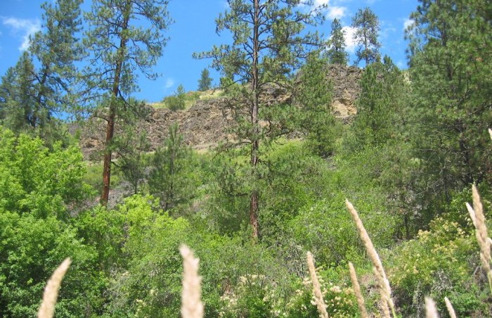
According to A TopoZone Map, This Dark Outcrop Is Called Dirty Head.
.It Is Probably Volcanic Rock and Likely Part of An Ancient Volcanic Flow Called the Columbia River Basalt Group.
.We Are Entering What Is Known as The Columbia River Plateau: This Is A Massive Volcanic Flow Area, Covering Half of Oregon & Washington. It Is One Of Earths Greatest Flows, Having An Average Depth Of Several Miles!
.Soon we leave the river and the old sleepy buildings
. (Cont. Next)
South Fork Clearwater River, just under 5 miles South Kooskia, ID. The volcanic rock seen in the /\ Above /\ Photo, is probably related to additional volcanic formations you will see in my upcoming photos at the top of White Bird Hill and the Salmon River Gorge some 50 miles SSW of here.
Continued From Previous Concerning NO Photos Of Kooskia, ID. .
Also. I was aware that the Narrator didnt actually mention this town by name, perhaps for these same depressing and uncomplimentary reasons.
Or perhaps the name Kooskia had the wrong poetic ring?
So, from all this, I finally decided to stick to my policy NOT to photograph towns NOT mentioned in ZMM. Besides, in addition to this policy, I had already many, many, times, chided myself for taking way too many photos! So my camera remained closed .
. Now I am not so sure I made the right decision not to photograph Kooskia. In fact, as I prepare these pictures for ZMMQG, I discover that I took way too few photos!
.Whats the moral?
.As soon as your Track of Quality hand reaches for the camera, take gobs of photos. Dont hesitate!! The sky is the limit!! And still you will not have enough photos, when you get home, and start to post photo views of your trip!!
*************************
(Photo = 110-1091c ...... ZMM Page = 259 ...... WayPt = 274w 1388ft)