Friday, July 12, 2024:
Continued From Previous Photo
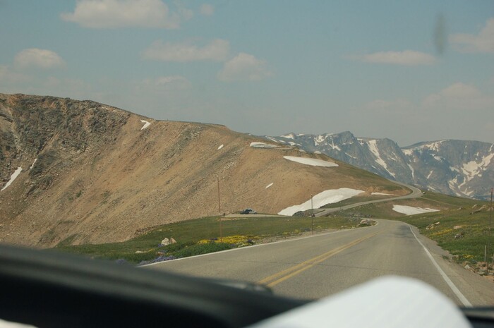
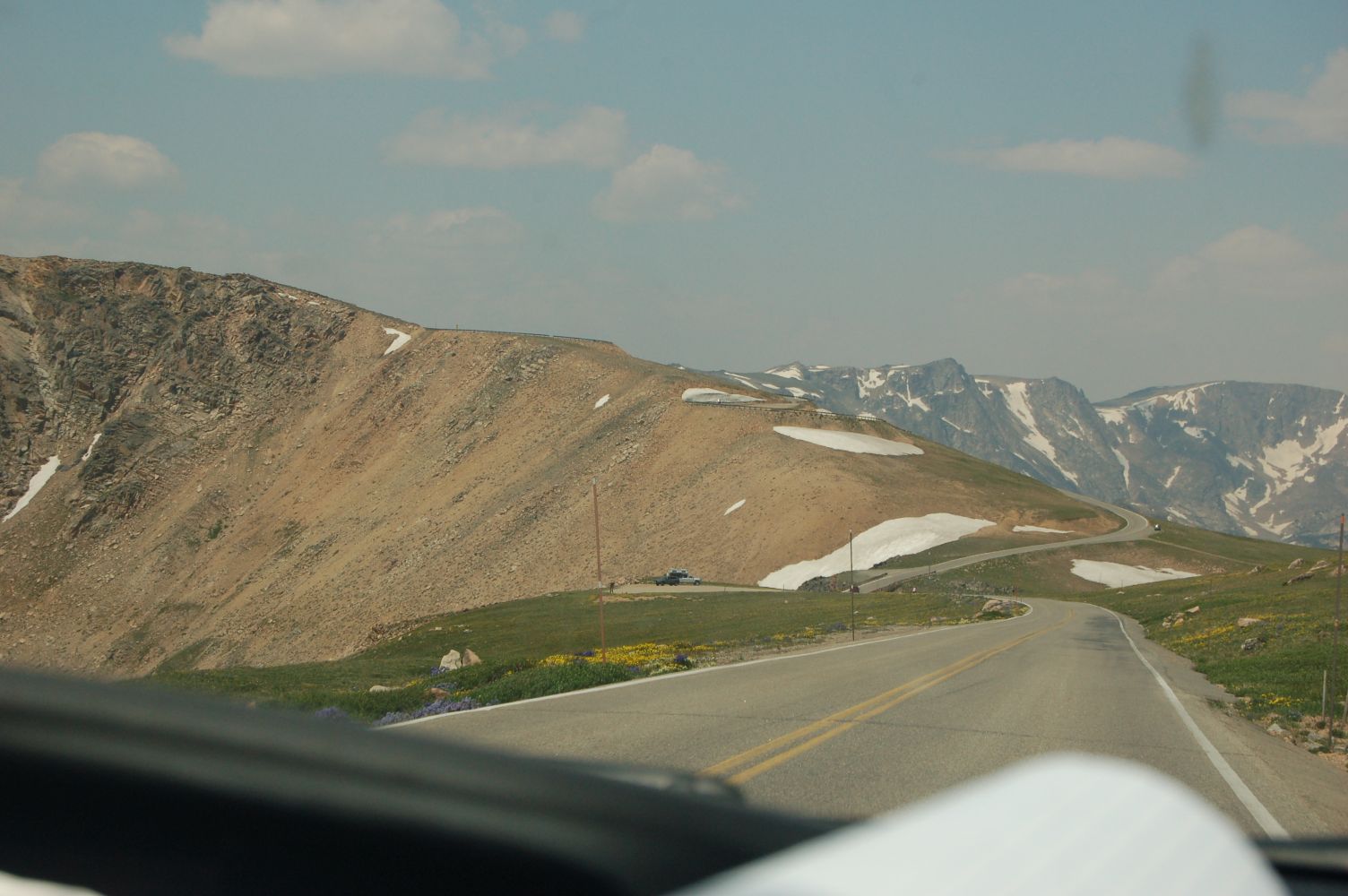
. A VERY Important Hog Back Land Bridge !!!
*** AGAIN STUDY THIS CLOSELY!!! ***
Be Sure To Click On The Photo, To Get Largest View, Then With Magnify Glass =>
. You Can See How Our Highway Goes Down, And Then Curves Down To The Left, And Then (Out Of View). Does A Right Turn Switchback, To Start UpOnTo The Hog Back Land Bridge!!
This Is Where You See The First Of FIVE Tiers Of Elevation, Each Of Which Is Followed By a 180 Degree Switchback, As Is Will Be Clearly Seen In The NEXT Photo.
Also Again, Look Closely To See About 1/3 Way Up, A Bit Of Pavement Between The Snow Banks.
*******************
Along The Beartooth Highway, In The Center Of The Beartooth Plateau, MN-WY Border Region, About 18.5 Miles Southwest of Red Lodge, MT.
*******************
For One Of The Worlds Highest Paved Highways, In The NEXT Photo, You May Extensively Learn About The HUGE IMPORTANCE Of This => Beartooth Highway Climbing a Hogback
.Which, For Human Travelers, Is A Highly Important Geographic & Geological Formation.
NOTE1: Concerning the information of the NEXT Photo => Please read it completely and then The FOLLOWING TWO Gallery Photos will have much ADDITIONAL Information & An Important Satellite View and Topo Map Photo, which will greatly increase your understanding of this Vital Place In The Center Of the Beartooth Plateau.
NOTE2: In my Summer of 2002 ZMM Route Research, when I Henry Gurr,, first drove the Beartooth Highway, I had no aware ness of the Hog Back Land Bridge, and of course no conception of its importance. And an emerging awareness ONLY started, when got to wondering why Montana Highway Department continues to use this stretch of road, despite the monster high winter snow buildup here. Eventually, I studied Topo Maps of the Beartooth Plateau, and found there was no other feasible connecting Land-Bridge, Between Two Otherwise Separated Major Hi Altitude Beartooth Plateau Areas.
Now, because of the HUGE A) Importance of the Hog Back Land Bridge, and this B) no other feasible, are not to be found in publications, you will therefore find an extensive discussion of this topic in the NEXT 21 Photos, especially Concerning Winter Snow Deposits.
*******************
New Topic => In 1968, When ON This Land Bridge, The ZMM Narrator Says =>
The snowfields become heavy and show steep banks where snowplows have been. The banks become four feet high, then six feet, then twelve feet high. We move through twin walls, almost a tunnel of snow. Then the tunnel opens onto dark sky again and when we emerge we see were at the summit.
Beyond is another country. .
In addition to Henry Gurr 2002 ZMM Research Photos of Very High Snow Banks, the Click Here For Opening Photo Showing A Great View Of A Beartooth Pass Snow Bank, a photo taken from the Lowest Tier of the mentioned previous photos, Hog Back Land Bridge, AND A Great View Of The Mountain Scenery Of The ZMM Narrators => Beyond Is Another Country.
NOTE: The above Blue Link also has a second good but small Merv Coleman Photo of => The Most Scenic Route to Yellowstone Park, as well as a good full discussion of => The most beautiful roadway in America, stated by On the Road correspondent Charles Kuralt, the Beartooth Highway climbs to an astounding 10,947 feet above sea level.
File = DSC 0248 Resize1504x1000 ~154KB