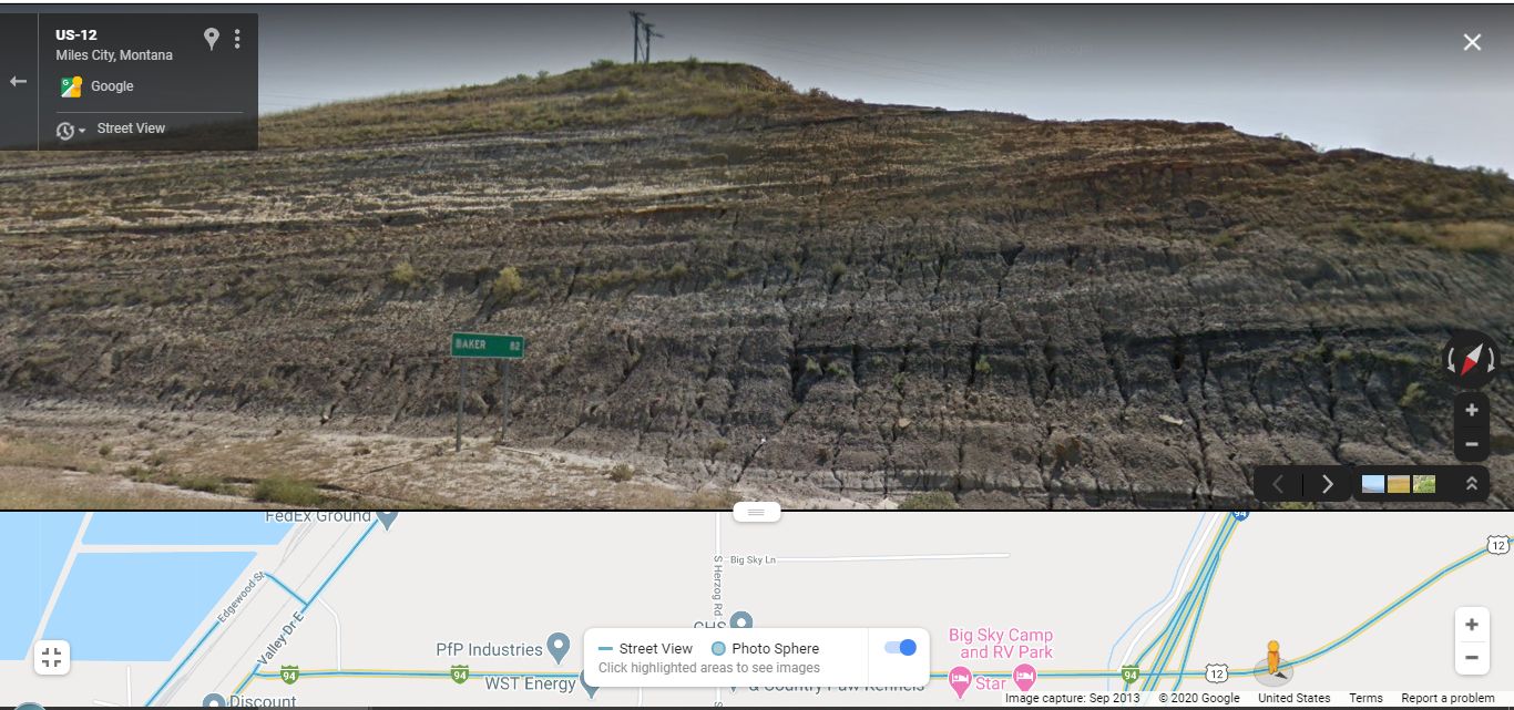
ContFmPreviousPhoto: => A View of Horizontal Multi-Colored Layers Of Volcanic Dust, & Mountain Rock
~8:24 pm Mon 12 Aug: Driving US 12, ~1000 feet East of I-94, By Baker, MT Highway Marker Sign, Miles City, MT.
.
IDEA! YOU CAN CONTINUE A GSV DRIVE EAST ON US 12: TRY IT YOU WILL LIKE IT !!
YOU MIGHT ENJOY A ~60 MINUTE GSV DRIVE US 12 TO THE EAST, AND ALONG THE WAY SEE =>
..A) Many MORE Examples of /\ Above/\ Photo Horizontal Multi-Colored Layers Of Volcanic Dust, & Mountain Rock That Continue To Beyond ZMM Book Burning Hot Badlands East of Marmarth, ND.
..B) With Gradual Increase in Elevation, To The Ridge Top, Shows The Dry Grassy Hills Get Gradually More More & More Trees.
..C) Some 30 Miles of ZMM Book Scenes ((Which Blue Links Below)), Are Alternately Shown In Henrys 2002 ZMM Route Research Photos, As FOLLOWS =
1) The ZMM Book>s .. I can see the far side of the valley, away and below. I am a pioneer now, looking onto a promised land. AND the multi-colored layers of volcanic dust, are also seen in this photo!! (<= Happens to be different view of same rock pile at the Big Sky Campground, you saw in previous photo.) Click Here.
2) The Mountain Pass just East of Miles City, Click Here. (After Photo comes up => Click Photo several times to get biggest view.)
3) The Arid-Lands near Locate, MT, Click Here.
4) The Roadside Rest Area near Locate, MT. Click Here..where ZMM Book Narrator has previously said in earlier Awwsssuuume Bad Lands + Sun Blasting 108 Degree Heat => Even with dark sunglasses I have to squint my eyes into slits. Theres nothing but burning sand and pale sky so bright its hard to look anywhere. Its just become white-hot everywhere. A real inferno.
.Right Click and Open In A New Browser Tab And AFTER Comes Up, You Can Start your GSV Drive Up-Hill, And East On US 12.
Cont Next.Photo:
Photo File = GoogStVu MultiLayerVolcanicDust~1MiEstOf}MapShoI-94&BigSkyCampGnd EasSideMilesCitytMT.jpg
Posted 4 June 2020. Revised 7 May & 11 Oct & 24 Oct & 5 Nov 2020.
