ContFmPreviousPhoto:
7:35 am Tues 13 Aug:
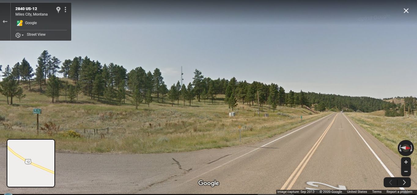
. US 12 Junction with Main Ridge Road, At Near Top of the Mountain Ridge Pass, ~11 Miles East of Miles City, MT:
Continuing From Previous Photo, Henry starts looking for A High-Ground Photo View Point, with Flowers in meadows & pines
WHEN
To the South, appears a Micro Wave Dish Tower:
. In /\ Above /\ GSV, This Hi-Ground Microwave Dish Tower Is Seen Upper Center, In Tree Gap.
.Hoping its on highest ground with a good West view, Henry goes toward it: Goal is to find shoot photos to illustrate Narrators whole passage, especially => huge valley and the river below in this passage =>
Then the rain comes hard on the road with a gust of earth-smell from the dust that has waited for too long and the dust beside the road is pocked with the first raindrops.
This is all so new. And we are so in need of it, a new rain. My clothes become wet, and goggles are spattered, and chills start and feel delicious. The cloud passes from beneath the sun and the forest of pines and small meadows gleams again, sparkling where the sunlight catches small drops from the rain.
We reach the top of the climb dry again but cool now and stop, overlooking a huge valley and river below.
Google Street View: Photo Note: Right Click and Open In A New Browser Tab => AFTER This GSV Comes Up =>
To the left, you will see the pavement of Main Ridge Road, and upper left center the Microwave Tower. Following the horizon line to the far right, you can also see distant tiny trees, on top of a uniform tan slope: This a major US 12 road cut, which in this view, is to the West. This major uniform dry grass slope, road cut, you can identify in several of my following photos (For example my Panorama From Top Of US 12 South Bluff.).
(ChangesSinceRobertPirsig1968Trip):
.After Robert Pirsigs Original ZMM Route Trip1968, There have been reports that this this stretch of US 12, from Mile City, MT to the Eastern Montana Border, may have had many major road improvements, including major moves of the road to new locations, a new bridge (& major road re-location) over the Powder River, as well as a really major new looking road-cut, seen in Henry Gurrs 2002, 2006, & 2019 Photos of this area, This New Looking Road-Cut< Is Seen In The 3rd & 4th Photos NEXT.
Cont Next.Photo => A PANORAMA VIEW Of => The ZMM Narrators ..walked into the meadow among the flowers under pines. ..
Photo File = GoogStVu1309 MainRidgeRdJunctUS12~11MiE}MilesCityMT HsgPixRt}PhonTowr+RdCutRtEdge01.jpg
Posted 12 June 2020. Revised 17 Junje & 13 May & 11 Oct & 18 Oct & 5 Nov 2020.
