Added July, 2004
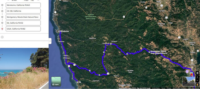
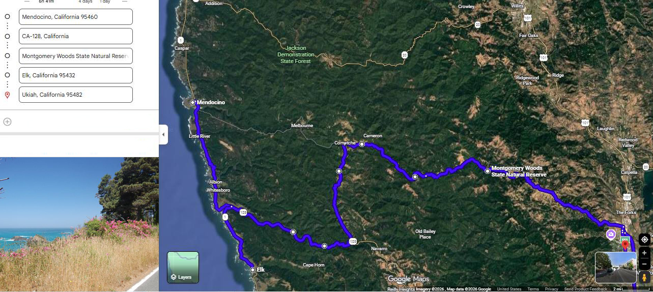
A SECOND, MORE DETAILED, SATELLITE VIEW OF DAVID MATOS & HENRY GURR Wednesday, July 24, 2024 TRAVEL, SOME OF WHICH IS ZMM ROUTE =>
Upper Left: See Caspar, CA. > START: Mendocino, CA, Go South On Along Point Cabrillo Drive, THEN Along California Coastal Highway US-101,
And By Mistake Go On US-101,To Some 25 Miles South Of Rt-128 (Near Elk CA), Then Go Back North To Rt-128 And Go East,
And On Various Backcountry Roads, To The Comptche-Ukiah Road,
..THEN Continue On The-Comptche-Ukiah Road, To Montgomery Woods,
THEN Ukiah, CA, UnLabeled At Red PinPoint,.Lower Right.
At Lower Left, Is => View Of Pacific Ocean & Flowers, Seen As Driving South From Caspar, CA Along Rt-1, And Photo Stop ~1.3 Mile North Of Mendocino, CA.
********************
EXPLANATION:
After saying Goodbye to Nancy & Steve Sappington in Mendocino, CA, David & Henry returned to Rt-1 California Coast Highway South, and completely failed to notice that we missed the ZMM Route Eastward turn-off onto the Comptche-Ukiah Road, which was just after the bridge for the so-named Big River. As a consequence, we enjoyed more views along the California Coast, and more beautiful flowers, which will be seen in forthcoming Photos and Panoramas.
NOTE: The so-named Big River, is just an ordinary-sized river, which is seen & followed at several places along the ZMM Route.
. This river really should have kept its original name, which was the Big Redwoods River. But unfortunately, the name and these Giants were long ago chopped down and gone! :-((
********************
You May Bring Up The /\Above Satellite View, And Conduct Your OWN ClickDrag Exploration (Plus Zoom In For More Detail). Click Here..
********************
File = ScrnCap GoogSatMendocinoCaElkCaRt-128ComptcheCaMontgomeryWoodsCAUhiahCa (1)