Added July 2024:
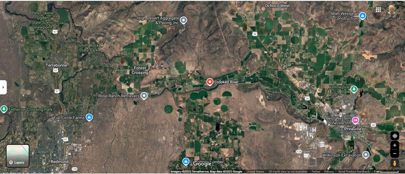
A Satellite View Of The Crooked River Valley, And Road FROM Prineville. Oregon, TO Prineville Junction, Oregon.
This Is Rt-370 (ONeil Highway) From Prineville, Oregon, Which MUST Be The Road West, Which Author Robert Pirsig Followed In 1968.
The ZMM Narrator Says =>
.We arrive in Prineville Junction with only a few hours of daylight left. Were at the intersection with Highway 97, where well turn south,
. .
********************
EXPLANATION =>
The Above Satellite View Shows The Valley Of The Crooked River, And Looking Closely At The Pinpoint, You Can See A Road, Which Is Rt-370 (ONeil Highway): This Road Connects US-26 In Prineville, Oregon (Seen Lower Right) > TO > US-97 Seen Lower Left (At Full Circle Farms).
As You Will Learn (In Forthcoming Photos), Rt-370 (ONeil Highway), MUST Be The Road Which Author Robert Pirsig, Would Have Followed In 1968: This Is The Only Backcountry, & Effective & ZMM Quality Way To Go From US-26 In Prineville, Oregon, > TO > To A Place That Author Robert Pirsig Called Prineville Junction
This Place Prineville Junction, In Reality, Is Not A Town, But Merely & Only, The Location Of A RR Junction Of => The Prineville Railroad, To The Main North-South Santa Fe Railroad, Which You Will Eventually See In A Panorama Photo, Forthcoming.
Click Here To Bring Up The /\Above/\ Satellite View, And Do Your Own ClickDrag To Explore => The Valley Of The Crooked River: Obviously Wide, Flat, And Fertile, Agriculture Productive, Valley, Especially With Easily Available Irrigation Water From The Crooked River. .
File = ScrnCaptGoogSatt CrookedRiverValleyWideFlatFertile AtPinPtRt370ONeilHighway
