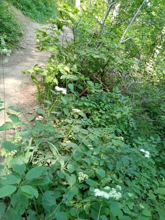
A View Of Flowers & The Trail, ~200 Feet From The Gallatin National Forest Trailhead, Cottonwood Canyon.
… At the beginning of ZMM Chapter 4, In the book => “Zen And The Art Of Motorcycle Maintenance” (ZMM). … Author Robert Pirsig writes =>
….“ Every Chautauqua should have a list somewhere of valuable things to remember that can be kept in some safe place for times of future need and inspiration. Details. And now, while the others are still snoring away wasting this beautiful morning sunlight . . . well . . . to sort of fill time . . .
What I have here is my list of valuable things to take on your next motorcycle trip across the Dakotas.
… and store it in a file at home to check off when I am ready to go.
Most of the items are commonplace and need no comment. Some
.A copy of Thoreau’s Walden . . . which Chris has never heard and which can be read a hundred times without exhaustion. I try always to pick a book far over his head and read it as a basis for questions and answers, rather than without interruption. I read a sentence or two, wait for him to come up with his usual barrage of questions, answer them, then read another sentence or two. Classics read well this way. They must be written this way. Sometimes we have spent a whole evening reading and talking and discovered we have only covered two or three pages. It’s a form of reading done a century ago . . . when Chautauquas were popular. Unless you’ve tried it you can’t imagine how pleasant it is to do it this way.
I see Chris is sleeping over there completely relaxed, none of his normal tension. I guess I won’t wake him up yet.
Camping Equipment includes:
1.Two sleeping bags. 2.Two ponchos and one ground cloth. These convert into a tent and also protect the luggage from rain while you are traveling. 3.Rope. 4.U. S. Geodetic Survey maps of an area where we hope to do some hiking. “
200 Feet Beyond The Trailhead, Cottonwood Canyon, Gallatin National Forest, Gallatin Gateway, MT.
NEW TOPIC:
….The Narrator (i.e. Author Robert Pirsig) most certainly used Topographic (Topo) Maps to explore his high country, both for Beartooth Plateau Southwest of Yellowstone National Park, AND in Gallatin National Forest South of Bozeman. This is very likely because (in the above passage), he tells us in his check-off list are => “ US. Geodetic Survey maps of an area where we hope to do some hiking. “ (See his list of travel and camping gear, Early in ZMM, Chapter4, p 036.)
…We can infer that these maps were used ALSO to plan the climbing route, in the writing of ZMM Part III, and in Author Robert Pirsig’s July 1968 actual mountain climb, regularly check their course during that climb. These very maps (or similar), were likely on Pirsig’s desk during the 4 years he planned, and did his writing, re the high country and mountain hiking portions of ZMM.
..****************..
(Photo = 20240717_103349.jpg
