The Road Twists And Twirls Over More Dry Grass Covered Hills.
.Chris Had Never Seen the Road Ahead Before!
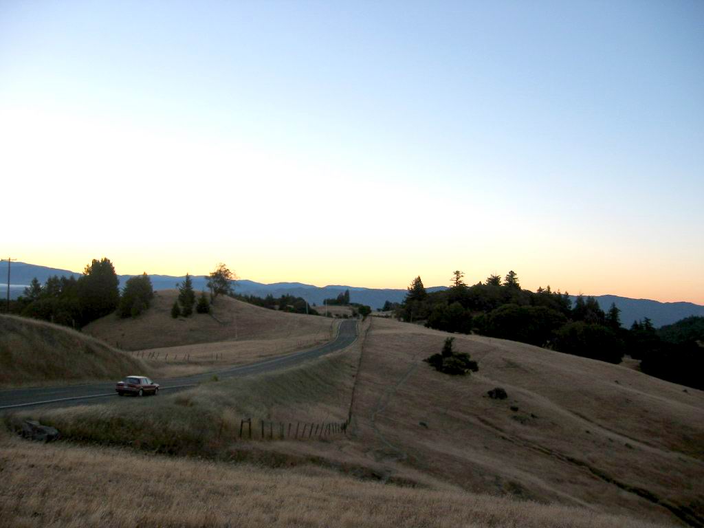
[ The road continues to twist and wind through the trees. It upswings around hairpins and glides into new scenes one after another around and through brush and then out into open spaces where we can see canyons stretch away below.
..."Beautiful!" I holler to Chris. ]
... "You dont need to shout," he says.
..."Oh," I say, and laugh. When the helmets are off you can talk in a conversational voice. After all these days!
..."Well, its beautiful, anyway," I say.
...More trees and shrubs and groves. Its getting warmer. Chris hangs onto my shoulders now and I turn a little and see that he stands up on the foot pegs.
..."Thats a little dangerous," I say.
..."No, it isnt. I can tell."
...He probably can. "Be careful anyway," I say." (Cont Next)
At ~8700 Orr Springs Backcountry Road, Traveling Towards The ZMM Route Town Of Ukiah, CA:
..A) ~36.3 Road Miles East of Mendocino, CA and.
..B) ~8.1 Road Miles West of Ukiah, CA.
. RIGHT CLICK AND SELECT NEW TAB => After Satellite Map View Comes Up, You Will See What Is Most Likely The ZMM Route => On Orr Springs Road, Which At Upper Left Twists & Sharp Turns, Among Hills of Dry, Brown Grass, Spotted With Clumps Of Dark Green Trees.
ClickOn The Plus&Minus To Zoom. You can Click&Drag The Map In Any Direction, To See More Off Your Screen Edges.
.In the /\ Above /\ Photo, the Red Pinpoint marks Henry Gurrs Camera Vantage Point at WayPt 472. Just to left, you see a Lighter Tan Color, which marks the slight hill, giving a Hill Top View for this Photo.
*************************
(Photo = 117-1736b ...... ZMM Page = 372 .... WayPt = 472x 1273ft)