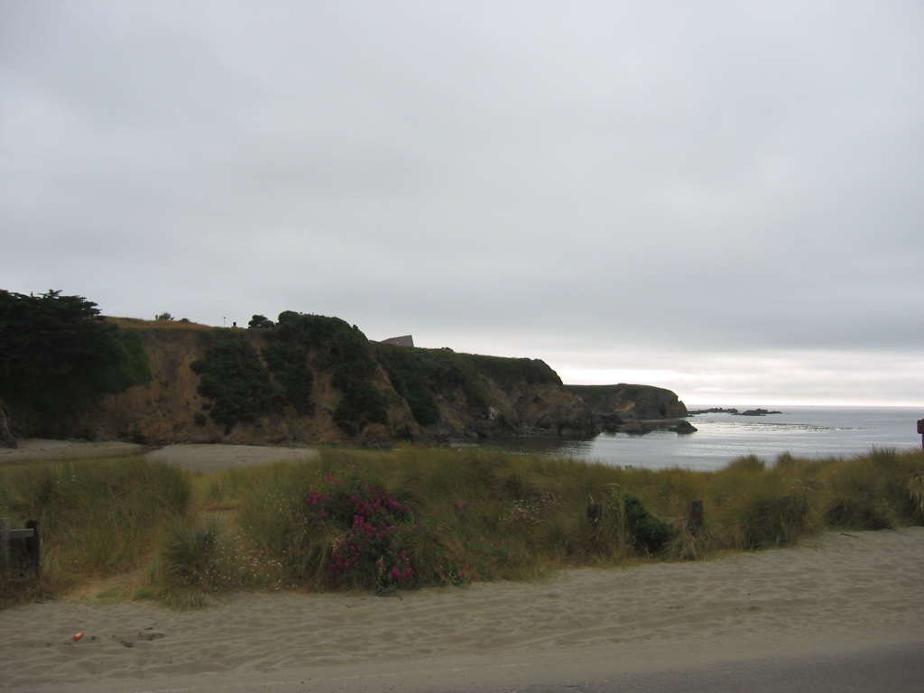
Looking Across The Sand Of Caspar Public Beach & Water Of Casper Bay, We See The Upper Edge Of Caspar Headlands, Along Which (In Silhouette At LEFT), Are Seen A Series Of Bushes.
You Should Click On Photo Several Times To Get The Largest View, Then Study The Sky-Line Between Bushes, And Identify (Look Closely) A Tiny Street Address Sign On A Narrow Vertical Metal Pipe.
(Looking More Closely) , Just Below This Sky-Line, The Upper Slope Of Road Point Cabrillo Dr Is Seen As A Line Between Tan Grass & Darker Roadway, Which Is Climbing The Grade To The Base Of the Street Address Sign.
This Base Approximately Marks The Upper Slope Of Point Cabrillo Dr, Arriving At Sharp Switch Back, Which Is At This High HillTop.
This Is The Approximate Location, The ZMM Narrator Calls A High Point. Please Remember This Because => You Will See This Same Approximate Location Discussed In The 2nd & 4th Next Photos. And subsequently 3 more photos.
. [The road leads out to the ocean again where it climbs to a high point that apparently juts out into the ocean] but now is surrounded by banks of fog. (Cont Next)
Back-bay Caspar Beach Park, one half mile SouthSouthWest of Caspar, CA.
As Discussed In The 4 Previous Photos =>
.The OLD Road (Rt-1), ZMM Narrator used in 1968, came from The Caspar Inn, angled down & curved around on a wooden trestle, crossed Caspar Creek, and then joined present day Point Cabrillo Dr. This is the road (/\ Above /\ Photo), that climbs the slope of a hillside, to reach the Oceans High Edge, which is The Narrators A High Point .This Point Is Above Caspar Beach, where The Narrator saw => Where Some People Rest In The Sand This you will see Next Photo.
To Best Understand How The /\ Above /\ Picture, Fits The ZMM Narrative, You May Need To =>
A) Go Back 4 Photos And Study The Satellite View, OR
B) Perhaps Even Better, Clicking On Either Of The Blue Links Below.
. To Further Explore This Area or ZOOM IN => RIGHT CLICK AND SELECT NEW TAB => => After Satellite Map View Comes Up, ClickOn The Plus&Minus To Zoom. You can Click&Drag map in any direction, to see more off your Screen Edges.
***oo00O00oo***
. An Alternate => To Further Explore Caspar, CA and Caspar Bay On A Topo Map => RIGHT CLICK AND SELECT NEW TAB
And AFTER the Map View Comes Up, You Will See an AWFUL Clutter of Adverts That Are Impossible To Eliminate. => YOU BEST SHOULD =>
.Use Scroll Bar At Far Right => Adjust Green Topo Map Until You See JUST BELOW The Plus&Minus Upper Left. => A ClickOn For Full Screen. Click on it, and Adverts Will Be GONE.
.Then use Plus&Minus To Zoom. You can Click&Drag Map In Any Direction, to See More Off Your Screen Edges.
*************************
(Photo = 117-1712 ...... ZMM Page = 366 ...... WayPt = 464w 0040ft)