After All The ZMM Narrators Stated Anticipation
.. Finally
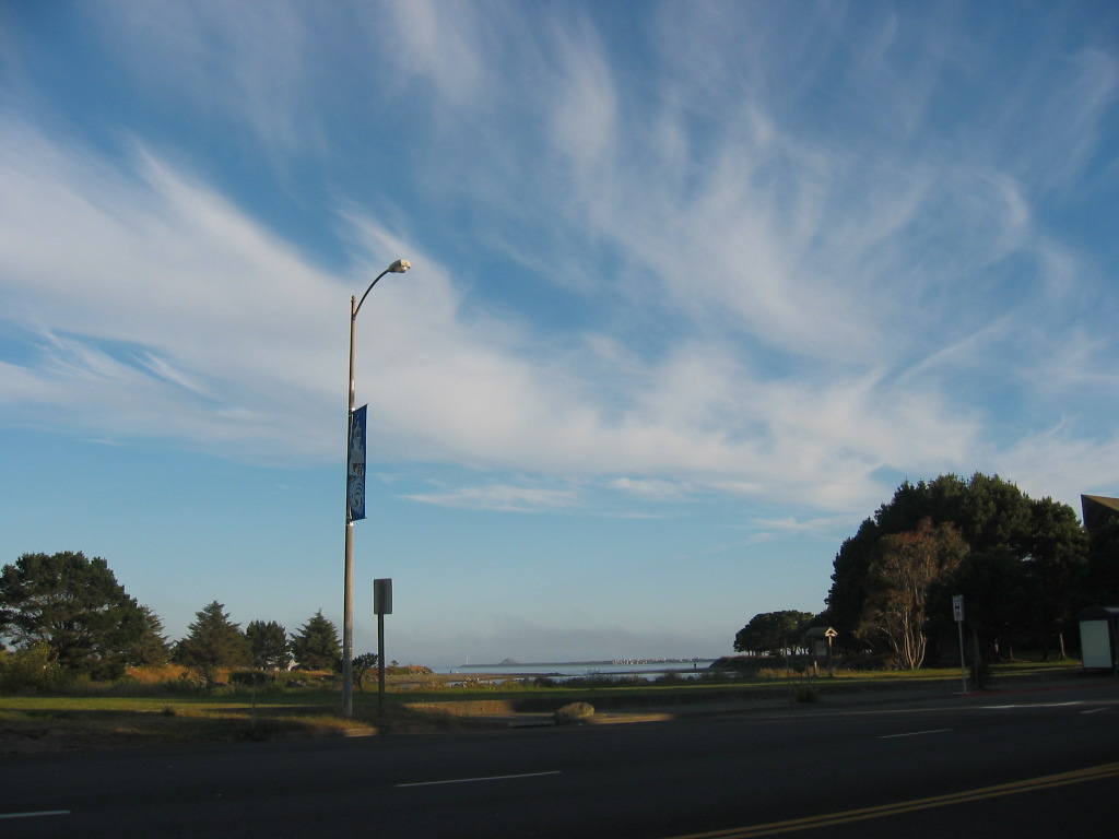
.. the Pacific Ocean! There It IS !!
. grey and cold and wet, and Chris and I look and see the water, the ocean, in the distance beyond piers and grey buildings. I remember this was our great goal all these days.
[Later on down the highway.] We enter a restaurant with a fancy red carpet and fancy menus with extremely high prices. We are the only people here. We eat silently, pay and are on the road again, south now, cold and misty. (Cont. Next)
First view of the Pacific Ocean, Battery Point, Crescent City, CA. The /\ Above /\ Photo was taken at an elevation of no more than ~20 feet, but here and later beach photos my GPS reads around 30 feet. Evidently, my GPS (at least in this area) reads elevation higher by this amount. Many other places I have given additional elevation data (as was available), so you the reader, can judge the comparative accuracy of my GPS elevation numbers. And I have decided to always report my GPS readings as given by my Handheld GPS Receiver, and thus allow the reader to decide how and when to use my elevation data.
How To Google Street View DRIVE The Streets To The Pacific Ocean.
The PREVIOUS Photo, Showed A Google Street View Of => A Clutter Of Buildings And The ZMM Narrators Sign-Strewn Road
This GSV was at 1130 US-101 Highway, Crescent City, CA.
The Instructions below, will guide your GSV Drive to Battery Point, where it will show the Lighthouse on an offshore island.
INSTRUCTIONS =>
After Google Street View (GSV) Comes Up, Then => Click the Google Street View Image, WHERE you want the VIEW To go. => Thus You Can Successively Click-Click-Click & GSV Drive Along The Street You See On Your Computer Screen. You Can Even Click-On A Side Street, To GSV Drive Along That Side Street !! (If Available.)
To Jump Ahead The Greatest Distance, Click On The Road The Furthest Distance Away.
. At any time you can Click-On The Plus&Minus To Zoom
. AND You can ClickDrag the Image On Screen in any direction, for a better view.
You SHOULD click at lower left to expand the Strip Map. The Yellow PegMan on this Strip Map, will show what direction you are going and your progress,
TO GSV DRIVE TO PACIFIC OCEAN AT BATTERY POINT =>
1) GSV Drive Click-Click-Click along US-101, and watch your position in the Strip Map at screen bottom, until you reach Front Street.
2) At Front Street, ClickOn this street to right, and GSV will make a right turn to the Southwest.
3) Click-Click-Click along Front Street until you reach its END at street named Lighthouse Way.
4) At Lighthouse Way, ClickOn this street to left, and GSV will make a left turn to the Southeast.
5) Click-Click-Click along Lighthouse Way until you go by a house and big bushes at right. Here Lighthouse Way turns slightly to left. Follow this which will turn slightly right at some marked parking places. Go by these until you can not get any closer to the Pacific Ocean.
6) ClickDrag the Image On Screen so at right you can see the Lighthouse on an island.
7) At this point => You can further explore what is here by => Click-On The Plus&Minus To Zoom
. AND You can ClickDrag the Image On Screen in any direction, for a better view.
Right Click Here, Select New Tab, And See Google Street View (GSV) For 1130 US-101 Highway, Crescent City, CA.. AFTER this GSV comes up, follow above instructions.
*************************
(Photo = 115-1566 ...... ZMM Page = 328 ..... WayPt = 418w 0052ft)
