ZMM ROUTE RESEARCH RESULT #1:
Searching For Businesses Within A Mile of the Prineville Railroad Junction =>
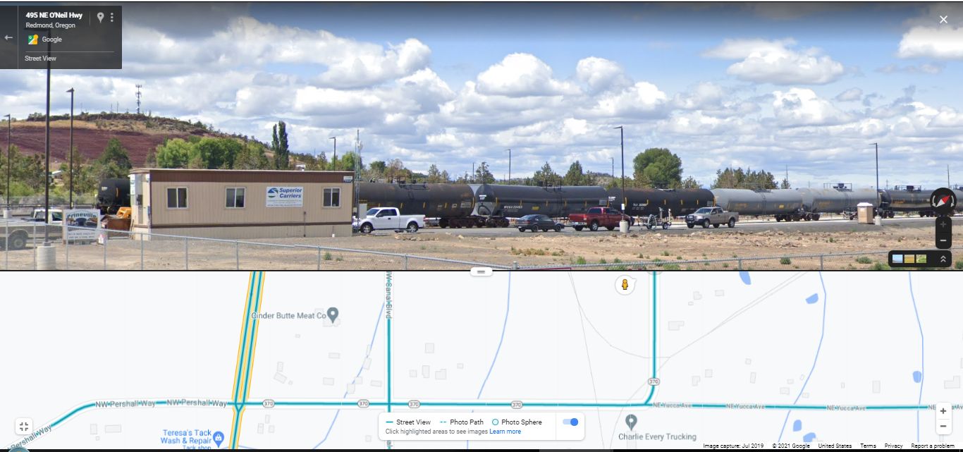
This Google Street View #1 (GSV1) Shows The ONLY Business That Looks Somewhat Like A Gas Station:
.This Is About Half Mile Away From US-97 And Is At Least, Where Robert Pirsig Could At Least Could Ask About A Gas Station.
.[ We arrive in Prineville Junction with only a few hours of daylight left. Were at the intersection with Highway 97, where well turn south, and I fill up the tank at the corner and then am so tired I go around in back and sit on the yellow-painted cement curb with my feet in the gravel and the last rays of the sun flaring through the trees into my eyes. ] (Cont. Next)
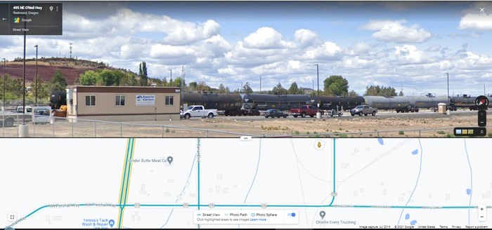
Traveling West On Rt-370 From Prineville, OR, The First Business Where Robert Pirsig In 1968 Might Ask For Information As He Was Arriving At, Prineville Junction, OR. As discussed in the previous photo => The above ZMM Passage takes place in Prineville Junction, OR some 17 miles West of Prineville OR. And to get there most efficiently, The Narrators ZMM Route follows the O'Neil Highway, Rt-370, in the scenic Crooked River Valley, somewhat paralleling the route of the Prineville Railroad.
.Click Photo To Get The Largest View, Then Look Closely =>The Bottom Strip Map Shows =>
1) Green Highway Line having Ovals with 370. This is ONeil Highway, Rt-370, and The ZMM Route from Prineville, OR, 17 miles to the East.
2) At Left: The Double Green Highway Line is US-97.
3) The Narrow Green Lines mark irrigation ditches.
4) The Narrow Very Faint Gray Lines Are Railroad Tracks.
5) Above the words Charles Every Trucking, you see Gray Line Railroad Track Lines that form kind of a curved triangle. There you can see where the Railroad Track =>
a) From the North switches into a curved track that goes EastNortheast. AND
b) From the South switches into a curved track that joins into a) above.
c) The approximately North-South Tracks are the Burlington Northern Santa Fe Railroad,
.6) SUMMARY =>: This is literally A "Prineville Junction" , achieved by Railroad Tracks Joined!
..****************..
SIDE NOTE:
In The /\ Above /\ Photo, Bottom Strip Map Shows => Gray Line Railroad Track Lines That Form, Kind Of A Curved Triangle. This Can Also Be Seen In Satellite View =>
In This Satellite View => The Red-Brown Triangle, Just Right Of Center, Marks The Location Of The Railroad Tracks For The Literal Junction => Of the City of Prineville Railroad Track, there to join the North-South tracks of the Burlington Northern Santa Fe Railroad, and apparently also the-Union Pacific Railroad.
..****************..
The Next Photo Has A Full => EPILOGUE: CONCLUSION SUMMARY.
*************************
(Photo = GoogStVu RrXferFacilityTankTruckRt495OnielHy StpMapN-StrackJunctionTriangleTracks.jpg ...... ZMM Page = 293 ...... WayPt = NotAssigned )