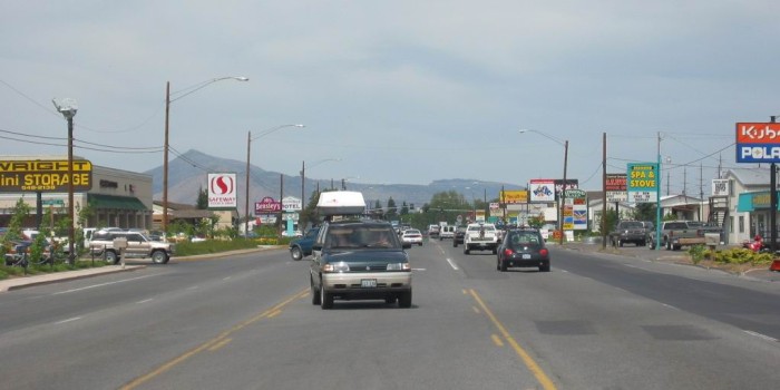
Looking North Into Busy, High Speed Traffic, Commercialized & Cluttered-Up US-97.
.Although The ZMM Narrators Journey South On This Road Was At Dusk, My Trip (and Photos) Are At Mid Day.
.[ I watch the cars go by for a while on the highway. Something lonely about them. Not lonelyworse. Nothing. Like the attendants expression when he filled the tank. Nothing. A nothing curb, by some nothing gravel, at a nothing intersection, going nowhere.
]
. Something about the car drivers too. They look just like the gasoline attendant, staring straight ahead in some private trance of their own.
(Cont.Next)
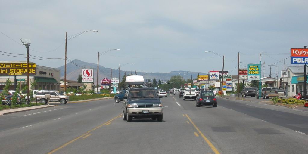
Main Drag, Central Redmond, OR.
.As has been mentioned in previous photos, the ZMM Narrator fails to mention places he doesnt like, such as tourist attractions and towns.
.AND, as you can see in the above photo, there are plenty good reasons why the Narrator neglects to mention Redmond, OR (Similar reasons apply to the previously unmentioned, traffic bustling town of Prineville, OR.)
..****************..
DATE-LINE: July 8 2021. by Henry Gurr.
AN EXAMINATION OF THE REASONS FOR => THE ABRUPT 90 DEGREE TURN SOUTH AT PRINEVILLE JUNCTION?
If You Look At A Road Map (Or Satellite View Such As Blue Link Previous Photo), You Will See That The Narrators Travel Has Been Directly West Ever Since Baker City, OR And Approximately West Ever Since Bozeman, MT. So ... If Seeing Crater Lake (Or A Shorter Route To California) Was In Robert Pirsigs Original Plans, Then Maps Show Shorter, Higher Riding Quality Roads, To Crater Lake.
.Now, Since The Narrator Did Not Take These, Then We Must Conclude There Must Have Been, In Reality, A Sudden Change Of Narrators Plans, Back At Prineville Junction, OR.
.As fully discussed in the Previous 6 Photos, the Narrator took the Crooked River Route (O'Neil Highway, Rt-370). This back-country, narrow, low traffic, scenic road, away from bustling high-speed traffic, certainly is consistent with the Narrators desire to take the lesser traveled by-ways. There, he choose a scenic Rt-370, low-traffic highway, to go West from Prineville, OR, to Prineville Junction, OR, thus avoiding the faster, more high speed traffic on the more recently constructed Rt-126, which goes directly between the major cities of Prineville, OR and Redmond, OR.
All This Is Very Reasonable Until We Trace The ZMM Route West On A Map =>
.We find Pirsig and Chris making a bee-line West through Central Oregon, essentially on US-26, as may be seen on a Road Map (Or Satellite View Such As Blue Link Previous Photo).
.Seeing this bee-line West through Central Oregon, we would expect the Narrator to continue essentially West to the Pacific Ocean.
This Is Supported By =>
.Pirsig (The Narrator) was quite keen on reaching the Pacific Coast. Saying for example =>
..1) At Klamath Lake Roadhouse, Narrator says
could have gotten to the ocean much quicker by another route. AND
..2) In Chapter 29, upon arriving at the Pacific, the narrator remembers, "this was our great goal all these days.
NOW
This Is Further Supported By =>
..3) Author Robert Pirsigs own Pre 1959 Proposed Road Trip Routes of Travel, going essentially West to the Pacific Ocean, by the Columbia River, and then following Coast Highways to San Francisco. This was essentially an On A Map Draft of A Possible Trip Out West, => Marked Out With Felt Tip Marker By Pirsig Himself On A 1951 National Geographic USA Wall Map Well Before His Actual 1968 trip.
..4) In Addition => There must have been, in reality, a last minute change of plans at Prineville Junction, OR, since there are plenty of other good (and perhaps better), low traffic byways to Crater Lake, which was evidently the Narrators chosen goal. (For the following, look at your map.)
.Given the Narrators criterion, an obvious choice (with shorter total physical distance), would be to travel the High Riding Quality, secondary roads & scenic by-ways that have long stretches of low traffic.
For example, at town of John Day OR, turning South off US-26. where you see back-country roads, shown as small black lines on my Rand-McNally Maps. These eventually angle over to Bend, OR, avoiding many miles of high trafficked main highways and the bustling, detestable city of Redmond, OR, and perhaps even parts of Bend, OR.
To Read More On This Topic And Learn Why The Abrupt Turn South, Click Here.
**************************
(Photo = 113-1324c ...... ZMM Page = 293 ......WayPt = 356w 3240ft)