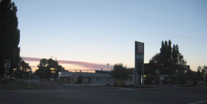
In Prineville, OR, This Is the ONLY Gas Station Where The ZMM Route On US-26, Meets a Road that Turns South. =>
.BUT Things Dont Fit => The ZMM Narrators Highway 97, Where Well Turn South,
. .
.Is 17 Miles Further West! Puzzle, Confusion, & Doubt Here!
.The real cycle youre working on is a cycle called yourself. The machine that appears to be "out there" and the person that appears to be "in here" are not two separate things. They grow toward Quality or fall away from Quality together.
.We arrive in Prineville Junction with only a few hours of daylight left. Were at the intersection with Highway 97, where well turn south,
. . (Cont.Next)
Junction US-26 and Rt-126, West side of Prineville, OR. In above passage the ZMM Narrators Prineville Junction., we assume is a towns name. But my 1988 Rand-McNally Map does NOT show any apparent Town of Prineville Junction, OR.
...And thus unfortunately in 2002, I missed going to (or photographing) this location, because the town and the Narrators road to go there, were NOT marked on the map I carried with me. .
.But belatedly & later => With the help of TopoZone Maps, I discover that there was indeed A Prineville Junction, OR, 17 miles West of Prineville, OR, and is located almost exactly on the Narrators Highway 97, Where Well Turn South,.
.But even much later, by happenstance, I belatedly discovered Prineville Junction, OR was indeed also marked on a map, along with also the town of ONeil, OR: This was on my 1964 Rand-McNally Map, just 4 years older, and old enough to still show Prineville Junction, OR!
Which is **AHA**! => How I Found Out Where Prineville Junction, OR Just Happened To ORIGINALLY Be Located!!
.Eventually I learned that =>This supposed town was merely, literally, & only => The Prineville Railroads Junction, at a true Railroad Junction, where it joins the Burlington Northern Santa Fe Main Railroad Tracks. AND this was ORIGINALLY Just A Dot On A Map, which is just 0.36 mile East of US-97, and four miles North of Redmond, OR.
.AND, of course, old maps are likely how Author Robert Pirsig knew of it and wrote it into his ZMM Narrative.
..****************..
Thus Confusion & Doubt Are Banished: All This Above Agrees With The Narrators Above Passage, AND Tells Us =>
A) Practically The Only Quality Road Robert Pirsig Could Have Use In 1968, To Travel From Prineville, OR
TO
Prineville Junction, OR, Was The ONeil Highway AND =>
B) This, In Turn, Tells Us The ZMM Route Follows The ONeil Highway, Rt-370, Along The Scenic Byway In The Crooked River Valley, And Somewhat Parallels The Route Of The Prineville Railroad..
.To go to Prineville Junction, OR from Prineville, OR MapQuest.com shows => You follow US-26 to the West side of Prineville, then turn left onto Rt-126. Within 500 feet, cross the Crooked River and then turn right onto the ONeil Highway, Rt-370, which soon turns directly West, following the VERY Scenic Crooked River Valley!!
.Here we must mention that this => VERY Scenic Crooked River Valley, is in terms of Robert Pirsig and The ZMM Narrator, a High Quality Road, to be sought out by the ZMM Enthusiast!
.Or You May Want To Try The Excursion Train Ride!
Click Here To Go To The Website of City of Prineville to Buy Dinner Train By Ernestine Bousquet Jan 31, 2020.
..****************..
More Information About The Prineville Railroad, Which Runs From Prineville, OR
To
Prineville Junction, OR, By Way Of The Very Scenic Crooked River Canyon,
.Which Somewhat Parallels The Route Of The O'Neil Highway (Rt-370).
.This rail line, one of the USAs oldest city owned lines, operates freight service and the "Crooked River Dinner and Excursion Train" for you to enjoy should you ever get out here. This 17 mile Railroad ends at a true Railroad Junction, where it joins the Burlington Northern Santa Fe Main Railroad Line which runs from Pasco, Washington to Modesto, California. (( More From Wikipedia. Click Here. ))
.So NOW You Understand Where This Name Prineville Junction Came From!!
*************************
(Photo =113-1313cb ...... ZMM Page = 293 ...... WayPt = 354w 2881ft)