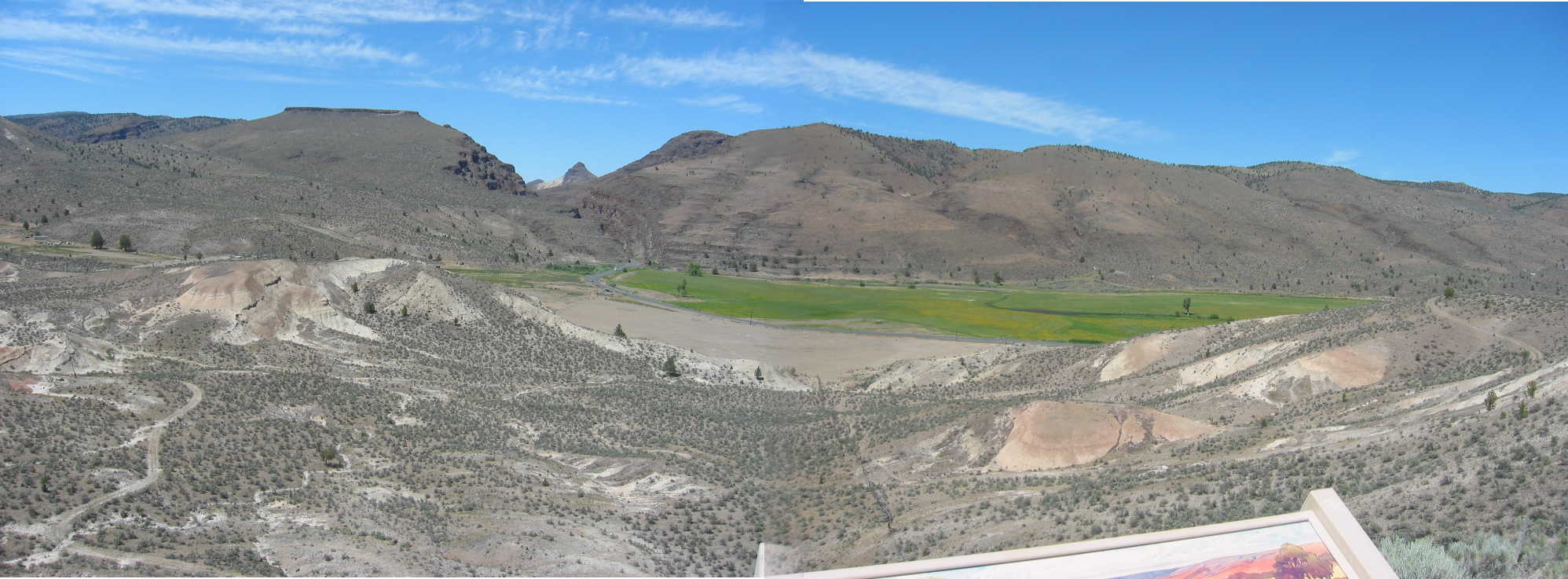
Looking North, From A Tourist View Platform, We See A Volcanic Rocky Ridge And The Awesome Desert!
.From Dayville, OR (Off Screen Right), The ZMM Route Road Is Barely Visible Line Between The Sandy Tan & Green Of The Valley Floor.
.You See The Road Curve North And Disappear Into An Unseen Crack (Narrators Rocky Gorges ) In These Volcanic Lava Formations.
.The desert road winds through rocky gorges
(Cont.Next)
Parking Area and Tourist Overlook, Southern Part of John Day Fossil Beds National Monument, 5 mi West of Dayville, OR.
1) The NEXT Photo shows a close up of the ZMM Narrators Rocky Gorges .
2) The SECOND NEXT Photo shows Sheep Rock Overlook at a Northern part of the John Day Fossil Beds National Monument, which is 2 miles North of the ZMM Route, 6 miles West from Dayville, OR
..****************..
.In the /\ Above /\ Photo, US-26 is that barely perceptible, grey strip this side of the green. Follow the road left and look closely to see its left curve disappear into the barely perceptible crack in the rocks! =>.A situation of Mu = Simultaneous Yes and No? Click on the photo to get the largest view.
..****************..
What The ZMM Reader & Traveler Should Know About The John Day River.
.The ZMM Route, came into the John Day River Valley, two miles East of Prairie City, OR, and followed it ~West for ~50 miles, through the small towns of Prairie City, OR; John Day, OR; Mt Vernon, OR; and Dayville, OR.
.Both the John Day River & ZMM Route, following US-26, will turn North to go through ZMM Narrators Super Deep & Narrow Rocky Gorges , whereupon the ZMM Route, following US-26, will turn West.
.But the John Day River, will continue North, go by the Sheep Rock Overlook at the John Day Fossil Beds National Monument, then with a meandering that will flow generally North West into the Columbia River. In a straight line, this is ~100 miles Northwest from these Rocky Gorges . .
. Right Click And Open In A New Tab. This Satellite View Will Come Up With The ZMM Narrators Rocky Gorges At Center. Zoom-In To Max, To See How Steep And Narrow Is The Gorge Nearest the Green Valley!
.After This Page Comes Up => You Can ClickDrag to =>
A) Follow ZMM Route, US-26, and the John Day River Valley East. Or
B) Follow ZMM Route, US-26, West over a mountain ridge to Mitchell, OR.
C) Follow the John Day River Valley, trending North, then a meandering Northwest, that will flow into the Columbia River.
*************************
(Photo = 112-1277 + 1sc ...... ZMM Page = 288 ...... WayPt = 340w 3532ft)
