The Previous Photo Discussed The Construction of The Lolo Pass Visitor Information Center, At The Maximum Elevation Of Lolo Pass.
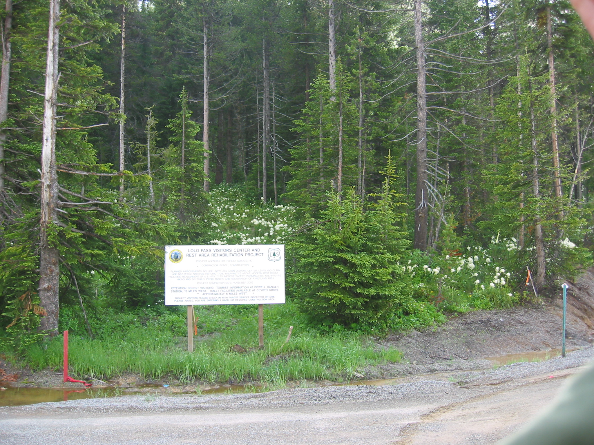
. The /\ Above /\ 2002 Photo, You Can Read This Signs Explanation Of The Various Government Agencies, Which In Partnership, Will Fund & Guide The Visitors Center Operation.
Lolo Pass, MT & ID Border.
DATE-LINE: June 13, 2021: by Henry Gurr.
Continued From Previous Photo => Changes Since Robert Pirsig 1968 Trip, As Seen By HSG in 2002.
.PLEASE NOTE => Being At Lolo Pass, This Visitor Information Center is located near BOTH a) The Nez Perce National Historic Trail, AND Lewis & Clark Historic Trail. This happens because Lewis & Clark needed a best way through these Treacherous High Mountains, and the Native American Nez Perce knew a good trail they had been using for 1000s of years!
This Visitor Center also provides information concerning the U. S. Forest Service (which controls most the land area around here), and provides visitor information for the states of Idaho and Montana.
.And in the /\ Above /\ Photo, as the Sign Says, The Visitor Center is a partnership of a) The National Park Service, b) The Nez Perce Tribe, and c) The Departments of Transportation in Montana, and Idaho. To construct the Visitor Center, there was concurrent extensive widening of the highway to provide turnoff lanes, etc.
NOTE Extensive Google Searches failed to find any additional information, or text, as to what this sign says.
************************
. Excerpt From USDA, National Forest Page, For The LOLO PASS VISITOR CENTER: This Page Shows At Top, A Small Photograph Of The Lolo Visitor Pass Visitor Center In The Summer.
.The Lolo Pass Visitor Center serves as one of the many historical landmarks off Highway 12, the Lewis and Clark Highway, bordering Montana and Idaho. The facility is located in the area where Lewis and Clark crossed over the Lolo Pass in the Bitterroot Mountains. The Lolo Pass Visitor Center and Rest Area is located along the Nez Perce National Historic Trail and is one of the designated sites of Nez Perce National Historical Park.
,,,,The buildings were a part of the near Lolo Hot Springs in 1923. In 1977 they were moved to Lolo Pass and restored to meet the increased demands of an information center.
[[The NEXT Photo, has further discussion of the whereabouts of => The Old Mud Creek Ranger Station. ]]
The visitor center displays information on the Lewis and Clark journey across the Bitterroot Mountains and the 1877 flight of the Nez Perce Indians and tells historical, natural, and general information about the area.
,,,,The facility currently includes an interpretive center, warming hut, 24-hour restroom, snowmobile parking lot, parking for other recreationists, and a 30-minute outer parking lot for larger commercial vehicles and other rest stop vehicles. You will find cross-country ski and snowmobile trails as well as a snowshoe trail for your winter recreation enjoyment. While recreating, you can stop in the warming hut for a cup of hot chocolate, tea or coffee, in front of a comforting warm fire. Winter season is quite busy as the Lolo Pass area serves as a major trailhead for cross-country skiing and snowmobiling.
....The visitor center sells parking permits and carries maps and winter usage information for visitors.
*** MORE INFORMATION ***
. This Map Shows => The Nez Perce National Historic Trail, which follows the route taken by a large band of the Nez Perce Indian tribe in 1877 during their attempt to escape death from US Calvary. AFTER this Map Comes Up, You Will See That This Trail is (somewhat parallel to and), a bit North of US-12, trending Southwest From Lolo Pass.
.Please see additional information below.
************************
Concerning The Nez Perce National Historic Trail, Our ZMM Facebook Page Has Information + Added Links To More Good Information + An Excellent Historic Trails Map, + This Summary =>
.On October 5th, 1877, Chief Joseph surrendered his band of Nez Perce to the US cavalry only 40 miles from escape across the Canadian border, making his eloquent and famous "From where the sun now stands I will fight no more forever" statement. However, Chief Joseph did continue to fight for his people, struggling against exile and reservation conditions as an advocate and a voice of conscience. The epic flight of the Nez Perce is detailed here, covering over ~1700 miles. The path of the Nez Perce is eerily similar to a reverse of Pirsig's motorcycle ride, sharing the same path in Idaho at White Bird Canyon where the first battle with US Cavalry took place, and then through Lolo Pass, and later through Yellowstone Park. Today, this route is commemorated as the Nez Perce National Historic Trail.
************************
. Please See The Above Blue Link=> For Additional Internet Links, That Go To Good Additional Information, AND A Very Detailed Map of Historic Trails, In Early Idaho & Montana.
*************************
(Photo = 110-1044 ...... ZMM Page = 243 ...... WayPt = 262w 5257ft)
