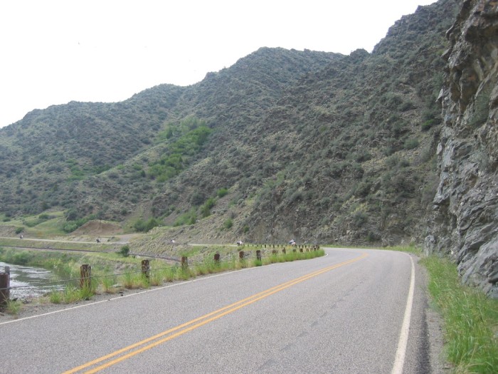
The Canyon Is So Narrow, the Road Is Jammed Tight Against The High Cliff .
.In The Distance, Look Closely To See 5 Cycles Coming This Way, AND Below The Cycles Brown Railroad Tracks Can Be Seen.
. The River Water Surface Looks Disturbed. But This May Be Due To The Sharp Curve Of The River, Rather Than Showing A Place Where True Rapids Are Found.
.[
. canyon of whitish-tan rock,
. ]
Along The Jefferson River, In The ZMM Narrators => [High Walled] . A Narrow Canyon Of Whitish-Tan Rock ~2 Miles SE Of, Jefferson Island, MT. . NOTE: Location is not the ZMM Narrators..At Three Forks . , but some 24 straight line miles West & a bit south.,
. RIGHT Click & Select New Tab To See A Google Satellite View Of The Location Of The /\ Above /\ Photo. This Will Help You Know WHERE Are located Significant Landscape Features, Discussed In The 8 Photos Hereabouts In This Album. AFTER This Satellite View Comes Up, Please Notice =>
..A) Upper Left Jefferson Island, MT, and LaHood, MT and
..B) The White Rt-2 Highway Markers, which mark the road from Three Forks, MT (at right off Satellite View), and from there, follow the Jefferson River. ((With the exception that, the Line for Rt-2 LEAVES the Jefferson River Valley (look closely) going North from LaHood, MT.))
.,C) Red Pinpoint marks Location of /\ Above /\ Photos, taken at WayPt = 235
..D) Zoom-In and then ClickDrag View up until you see the South-most curve of the river. Above the river, and by the highway, you see a Dark Spot. This is the Unusual, Lone, Large Tree mentioned, and seen in my SECOND Previous Photo ( = 109-0931 + 109-0932sc).
..E) The Tree of D) above, marks a bit further West from where my previously seen 3 photos were taken at WayPt = 232.
..F) At center right, Lewis and Clark Caverns State Park.
..G) North of Jefferson Island, MT, see where Rt-2 runs by I-90. Zoom-In, ClickDrag, and look closely to see I-90 has bridges over a river. This is the North Boulder River, which is mentioned in The Lewis & Clark Historical Marker Sign, SECOND Photo Next.
**************
(Photo = 109-0947 ...... ZMM Page = 235...... WayPt = 235w 4355ft)