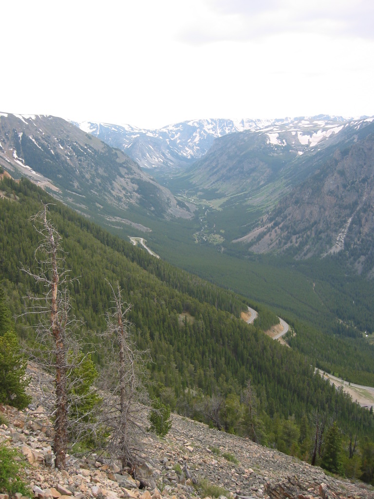
[ The Broad-Leafed Trees Are All Gone. Only Small Pines Are Left. Many Of These Have Twisted And Stunted Shapes. ]
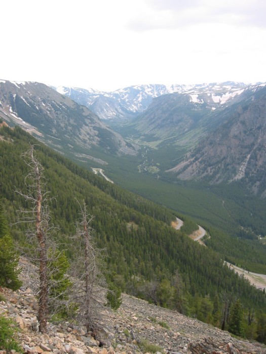
..From The High-Up Rocky Promontory Rock Creek Vista Point, A Southwest View of, Rock Creek Canyon, Upstream
.At Photo Upper Center, Can Discern, U-Shape Of Upper Rock Creek Canyon => Where The Whitewater of Tiny Rock Creek Can Be Seem.
. Closer & Angling Up From Right, Thru Center => See Three Tiers of Beartooth Highway, On the Way Up.
.Plus Further On => A Very Nice Switchback! This Is A Really Very Nice Hair-pin Turn!
Rock Creek Vista Point, First Roadside Rest Area, Beartooth Highway ~14 Miles South of Red Lodge, MT. In /\ Above Photo (lower left corner), please note the two stunted pine trees and no broad-leafs on the bare slope. This well confirms => The above ZMM Narrators Words.
A 360 Degree Panorama Really Needed.
. After I took the /\ Above /\ Photo, my next photo SHOULD have been swing the camera 45 degrees to the left, take next photo, and then keep taking the series of 8 photos for A Full 360 Degree Panorama. This would have shown the mountainside at the road entrance to this Rest Area.
.Moreover
and I dont know why
I had stopped my general practice of
=> Every important opportunity => Take Full 360 Degree Panorama Shots. I dont know why I did not take Panorama Photo good places in the many miles ahead, especially considering this was in The ZMM Narrators High Country .
.
Puzzling? .Why Did I Wait Until Well Into YNP For My Next 360 Panorama?
The thin high altitude air must have lowered my gumption, although I was not aware of it at the time. You, Dear Reader
should watch for this
when you get in similar circumstances.
DATE-LINE: March 25, 2021. by Henry Gurr.
In Retrospect => Thinking Further About Above Mentioned IN-Adequate Panorama,
.Where I Really Needed A Good One!
. Capturing this VERY DEEP CANYON, which was opposite to HIGH MOUNTAIN PEAKS, is clearly a difficult Panorama Photography Challenge! This calls for special imaginative & creative camera work that unfortunately I did not possess at the time.
.Before I walked away from the Rock Creek Vista Point => The thought should have arrived => Stop. > Ignore photos already taken. > Start over. > Turn Camera From Landscape to Portrait for Highest Vertical Field > Make a mental plan > Now capture it ALL.
This Google Street View (GSV) Shows => The Highway Approach To The First Beartooth Highway Rest Area & Rock Creek Vista Point.
Here A GSV Is Perhaps Better Than A 360 Deg Full Circle Panorama, Since It Can In Addition A) Look Farther Up AND Down, Plus B) Offers Ability To Zoom Magnify, And See Better Distant Details!! RIGHT CLICK AND SELECT NEW TAB =>
INSTRUCTIONS => After Google Street View (GSV) Comes Up, Then => Click the Google Street View Image WHERE you want the VIEW To go. => Thus you can Successively Click-Click-Click = GSV Drive The street you see on your computer screen. You can even click-on a Side Street, to GSV Drive the Side Street !!
You can always GSV Drive further to see more & more sights!! AND at any time you can Click-On The Plus & Minus To Zoom AND You can ClickDrag the Image On Screen in any direction, for a better view.
Every Google Street View (GSV) Has Available A Strip-Map => If You Click-On The Expand Small Map At Lower Left, The Strip Map Will Go To Complete Screen Width.
.AND everything said about how to manage the GSV Image, ALSO applies to this Strip Map. MOREOVER => If you want to jump to a longer distance location, you can simply ClickDrag the Strip Map to new locations. THEN a click on the Map, which will then jump your GSV to that place.
. This Strip Map at bottom, may have a note saying => "Click highlighted areas to see images. This means you should look just above it => For one or several Small Circles. Try clicking your mouse (several times) all around that area, and One Or Several Photos will be displayed.
.The pointer at the base of the Yellow Pegman may show the direction of this photo view.
. For More Hints On Using Google Street View (GSV), And What To Do If GSV Fails-To Respond Normally.
**********************
. Click Here To See Google Street Views DRAMATIC 360 deg 3D Panorama Type Photo From => Beartooth Highway, Rest Area & Rock Creek Vista Point. => AFTER Page Comes up, you will see a Google Street View (GSV) 360 3D Camera Photo, . The camera for this is located on a higher rock outcrop, beside (and looking North along) the ZMM Narrators a little path that takes us out to the edge of a cliff.
If things are working correctly =>
..1) You will see A Google 360 deg 3D Street View Capture from a single higher rock outcrop location on The Rock Creek Vista Point Area. For this SINGLE LOCATION => You can do all the normal Zoom and ClickDrag on The Scene to rotate and see 360 Full Circle.
.SIDE NOTE: This GSV wrongly says Gasparilla Island State Park, AND The Direction-Of-View-Pointer at the base of The Little Yellow Pegman points OPPOSITE of the GSV shown on your computer screen.
For the NEXT PHOTO, my camera was turned 180 degrees back toward the Parking Lot. And in this view, you will see more Beartooth Highway Tiers climbing even higher!
*************************
(Photo = 106-0614 ...... ZMM Page = 110 ...... WayPt = 135p)