View South, Looking BACK At The Rest Areas Parking Lot
Notice The Works Progress Administrations (WPA) Hand Made, Very Wide And Solid Stone Walls,
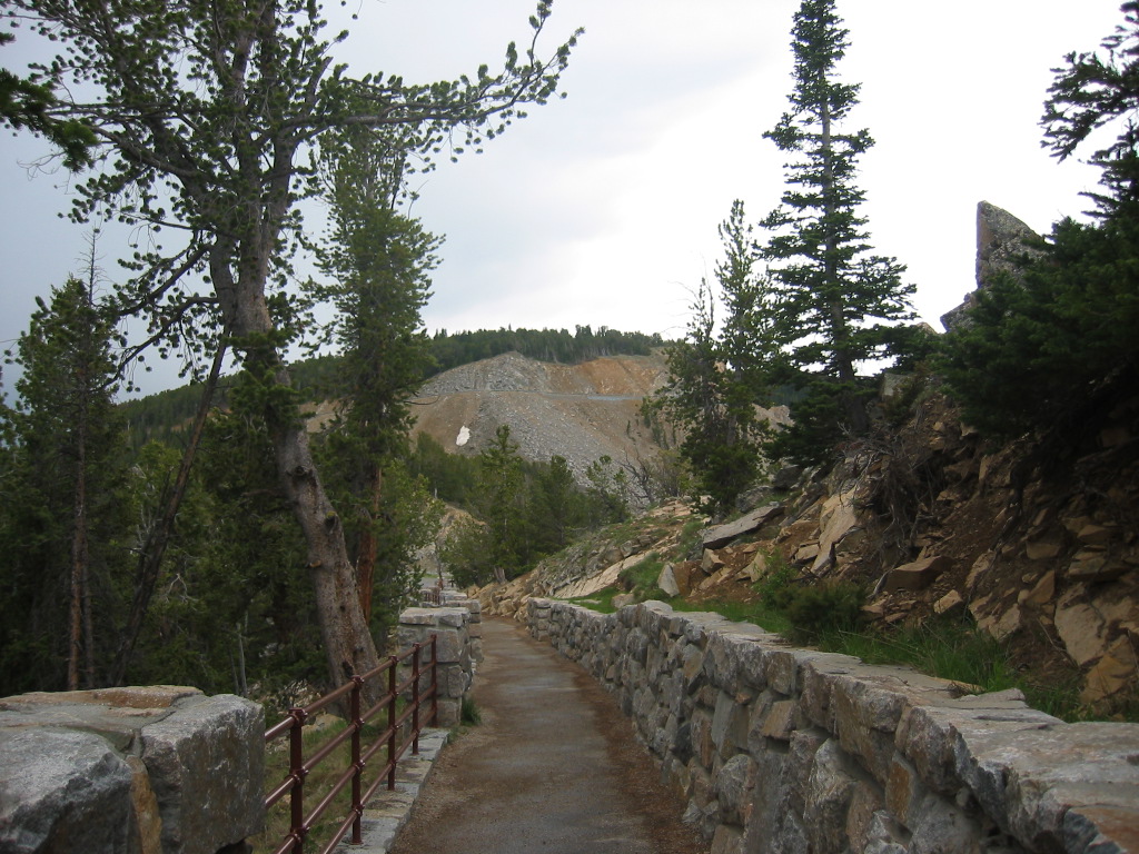
..Which Are Along The ZMM Narrators Little Path, at Rock Creek Vista Point,.
..Higher Up, Look Close, You Can See the Road Is Continuing Ever Higher.
. We bundle up more tightly against the cold and continue upward.
ZMM Narrators Little Path, Rock Creek Vista Point, First Roadside Rest Area, < First Roadside Rest Area, Beartooth Highway ~14 Miles South of Red Lodge, MT. This photograph shows the Narrator's Little Path on the way back from the cliff edge to the parking lot. Look closely, you will see the narrow path all the way to a lamp post, beyond which you can discern the pavement of the parking lot..
.At Right Notice The High Rocks Above The Wall => This Is The Location Of The => Higher Rock Outcrop 360 deg Camera Location, Which Was Mentioned In The Previous Photo, With Link To Go See A Dramatic GSV Type Panorama.
.Also be Sure To Notice The Works Progress Administration (WPA) Hand Made, Very Wide And Solid Stone Wall (Or Iron Railings). Clearly To Protect The Visitor From Falling Over The Edge.
.As discussed in earlier photos => This highway was a 1930-1935 WPA Civilian Conservation Corps (CCC) project. And I further surmise that this rest area plus, this stone wall, were hand made from local hand cut rock by the CCC men. Rarely do more recent highway constructions make such labor intensive installations that make this much use of local materials! Thus this is all pretty special! And you should take special notice of these walls when you are there!!!
.In the /\ Above /\ Photo => On the distant mountain, note the landslides from the rubble of constructing the road-cut. You can imagine the continuation of the switchbacks ever higher up!
.This rest area is over ½ way up the mountain. Altitude here is 9233 feet. So, it is a long way yet to the top at ~11,000 feet!
You better hope your engine is in good shape, or you will have to perform some very inconvenient on the spot maintenance! And make sure the weather will allow safe passage. This is no place for rookies, tender-feet, or the ill-prepared!! Author Roberts Quality is the order of the day!!
.****************.
. Click Here To See 9 More of Google Street Views Own Collection of 360 Degree 3D Panorama Type Photos Of => Beartooth Highway, Rest Area & Rock Creek Vista Point. => AFTER Page Comes up, you will see the first of some 9 Google Street View, 360 3D Camera Photos.
If things are working correctly =>
..1) You will see A Google 360 deg 3D Street View Capture of a single location in The Rock Creek Vista Point Area. For this SINGLE LOCATION => You can do all the normal Zoom and ClickDrag The Scene to rotate and see 360 Full Circle.
..2) You can then ClickOn => The Big Photos Lower Center Arrows (( < > )) => To go through the remainder of these. When I do this, all 9 appear of these Captures are much like 1) above, but show different people.
..3) The Panel At Left, when ClickDrag to full width, shows a Quick View of all 9, 360 3D GSV Camera Photo Versions: You can scroll up or down to see all these.
*************************
(Photo = 106-018 ...... ZMM Page = 110 ...... WayPt = 135q)
