The ZMM Turnoff Where Tourists Take Pictures. .
. We stop and park at a turnoff where a number of tourists take pictures and look around at the view and at one other. At the back of his cycle John removes his camera from the saddlebag. From my own machine I remove the tool kit and spread it out on the seat, then take the screwdriver, start the engine and with the screwdriver adjust the carburetors until the idling sound changes from a really bad loping to just slightly bad.
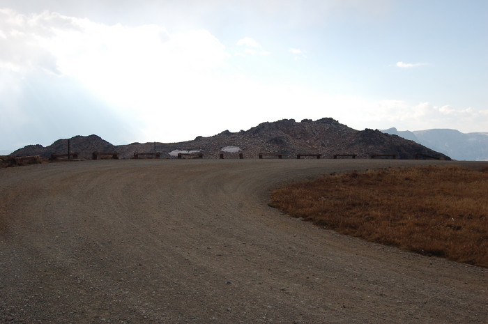
Second Roadside Rest Area, Beartooth Highway, WY. In 2002, I somehow I missed the turnoff to the place where tourists take pictures. This turnoff area with Parking Loop is shown in the topo map link below.
.This topo map also shows that the turnoff parking lot is high enough to have a Dramatic Full Panorama View in most direction except East. This would include Beartooth Mountain to the West, and Granite Peak to the Northwest. Granite Peak is the highest in Montana at 12,799 feet.
. A Really Grand & Full Panorama View, including East, is but a short hike away. The Topo Map shows =>
..A) A knoll North & A Bit West of the parking lot. AND
..B) A second somewhat Higher knoll, East of the Parking Lot: This is Stockaid Peak at BM Bench Mark 11,029 ft.
Google Finds =>
..C) A Short Ascent Report and How To Find The Bench Mark.
..D) A Full Hike Report + ~8 Photos + Gobbs Advertisements
..****************..
And When We Emerge We See Were At The Summit.
.Beyond Is Another Country. Mountain Lakes And Pines And Snowfields Are Below. Above And Beyond Them As Far As We Can See Are Farther Mountain Ranges Covered With Snow. The High Country.
.The Blue Link below, also shows, OH WOW, Lakes All Over The Place, as attested by the Narrator. But ZMM Traveler, such as myself, does not experience this many lakes: This is due to the irregular landscape and the return of dense forests!
.TopoZone Map Showing Beartooth Pass and Turnoff To Overlook Roadside Park. > After Map Comes Up > Upper left > Immediately Click-On Square > For full Screen.
..****************..
SIDE NOTE: Paper Road Maps Are Not Generally Not Good Enough To Show All The Switchbacks Of The Beartooth Highway.
Pirsig Pilgrims, especially since they really need to "go hiking", should bring good topo maps. Consider the Topozone Maps already mentioned. You of course may print one of these directly off your computer, or order a color plastic coated version from Topozone. .
************************************
(Photo = September 2006 0092 ...... ZMM Page = 111 ...... WayPt Assigned = ~145q = BM 10,947 ft)