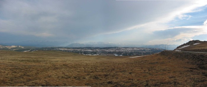
This Photo, Taken At The Highest Beartooth Highway Elevation, Really Is The ZMM Narrators The Summit !
.Valleys, Lakes, and Snow Covered Mountains Are Seen Twenty Two Minutes After the Tunnel of Snow.
.[
. and when we emerge, we see were at the summit. Beyond is another country. Mountain lakes and pines and snowfields are below. Above and beyond them as far as we can see are farther mountain ranges covered with snow. The high country. ]
About A Mile SW Of BM 10,947 feet, Beartooth Pass, Beartooth Highway, WY. Click on the photo to get the largest view.
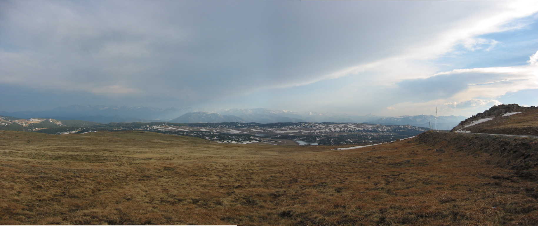
.As may be seen in a Topo Map (link NEXT Photo) the road before the Hogback Formation had traveled down a hillside, gone thru a low area close by a Benchmark (BM = 10,536 feet), and then slowly changes to a steady climbs at ~6 % Grade up the Hogback with all those four switchbacks. Going by the Twin Wall Snow, the road is at 10,736 feet, and must then continue climbing another 211 feet Up The Hogback, to arrive at /\ Above /\ Photo, AND The ZMM Narrators at the summit.
.Topo maps confirm that this is indeed the factual climax of our travel over what is officially here called Beartooth Pass. Here the highway elevation maxes-out at a Benchmark (BM = 10,947 feet), just nine feet higher the previous highway maximum mentioned earlier.
.As mentioned in NEXT Photo, there is knoll nearby, just to the East, named Stockaid. This knoll has the highest altitude anywhere around here (11,029 feet). If you clicked on my WayPoint = 144 = Beartooth Plateau Topo Map, you would see this is indeed a yet higher summit !!
.And in the /\ Above /\ Photo we are high enough to again to see the Wyoming high country to the South. You saw this same cloud formation and patch of light blue sky (West & Southwest) in previous photos.
.However, we are now seven miles further South. And from this high vantage point, you can see (mid screen) three small lakes, fitting those mentioned in the above ZMM Passage. You see as well, a nearer range of partly snow covered dark brown low mountains not seen in that previous high area photo.
.We are again on a high vantage point, somewhat level with the ridge in the medium distance: But the mountains on the far distant horizon are completely white snow covered, and thus considerably higher (13,140 feet).
.Be sure to notice in the /\ Above /\ Photo the road at left: This is Beartooth Highway, now on its way down, down, down, into the lower valleys ahead, which are before the Blue Haze Mountains, seen above the highway. And in these lower valleys we will again see lakes & rushing mountain streams.
.Note poles by highway These are to guide the snow plows.
*************************
(Photo = 106-0635-0636stitch ...... ZMM Page = ...... WayPt Assigned = ~145r = About a mile SW of BM 10,947ft)