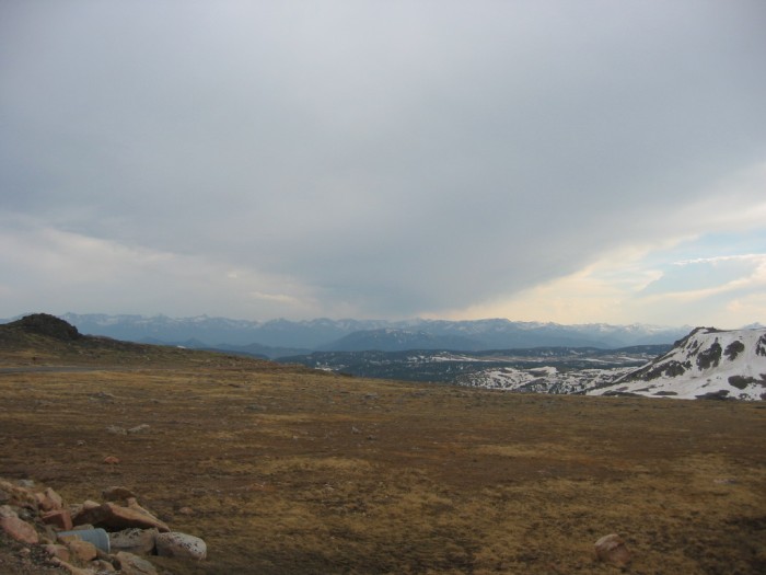
About 2.3 Miles South Of The Montana-Wyoming Border =>
….Looking Further South At The Mountains & Valleys of Wyoming’s Beartooth Plateau.
….We Are Looking Ahead To The Photos & Discussion Of => The ZMM Narrator’s High Country , BOTH Physical Landscape and Mental-Philosophic Landscape!
….[ “Dark sky now and cold. Except where the sun hits. On the sun side my arm and leg and jacket are hot, but the dark side, in deep shadows now, is very cold.“ ]
~ 1/4 Mile South of Ski Area, Beartooth Highway, Shoshone National Forest, WY. Now we have passed the first two maximum elevations on the Beartooth Highway.
..1) Near the Ski Area (10.938 ft).
..2) And factually the highest elevation of this highway (10,982 ft).
My notes and my GPS both show that we come down slightly to an elevation at (WayPt = 141`|w|' 10,968 feet) for the /\ Above /\ Photo.
..****************..
Please Notice In /\ Above /\ Photo =>
..A) My photo vantage point is on the edge of the pavement. Note the “only rocks” rubble pile, pushed over to make the mountain’s slope level for the highway. This is evidence that up here there is almost pure broken stone under the grass! This shows there is practically no top soil up here. It could be called “only rocky soil”!
..B) Also, please note general appearance of the rolled edge of the storm clouds, which are Running North to South. And note the opening in the clouds with the white blue sky (West).
..C) Remember all this in above B) => It will help you stay direction oriented in the photos to come. For examples =>
….1) You will see a Forthcoming Photo taken on the far side of that snow speckled closer range. This is seven miles further south, and in it => You will also see the same patch of sky, but by that point, the final downward descent from The ZMM Narrator’s High Country will be evident.
….2) Just beyond this valley ahead, you see another plateau practically level to here. Remember this general appearance, since it will help you understand the Six Photos FOLLOWING the ZMM Narrator’s “Tunnel of Snow”.
….3) At left edge of photo => Beyond the grassy slope, you can see the continuation of the road descending down toward a low area (valley), which is behind the snow covered mount at right. Remember this general appearance, because => In the NEXT Photo September2006 0075, you will see the same stretch of highway, that will finally show the previously much discussed “Hogback”, which is behind the snow covered mount at right.
************************
(Photo = 106-0625 ...... ZMM Page = 110 ...... WayPt = 141`|w|' 10,968ft)
