Into the Snow Fields A Second Time.
. The snowfields become heavy and show steep banks where snowplows have been.
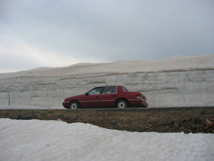
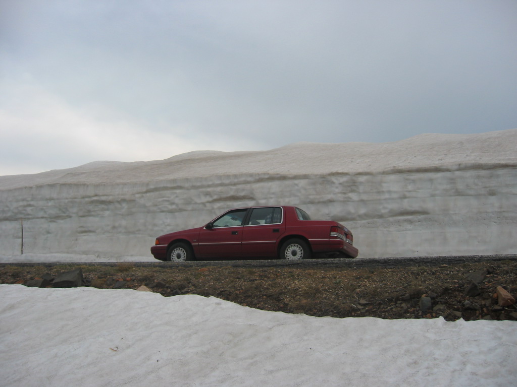
ZMM Route Second Major Snow Field Area, Hogback Formation, Beartooth Highway, WY.
..****************..
ONLY After I Got Around The Switch-Back Shown In The NEXT PHOTO, Did I Realize I Had Passed On By This Graphic Scene In /\ Above /\ Photo.
Here Are My Corrective Steps And On-The-Spot Mental Dialogue =>
. In Order To Take The /\ Above /\ Photo =>
.My paper notes say went back for snow bank. My mental dialog at that time =>
OK. Forget my normal practice of keeping my car off of highway AND out of the photo => Car and highway are now a required part of the photo.
.The car must be positioned to show the relative size of the snow banks. Your must position the car back there! Dont get hit by another car. Turn around in the middle of the highway. Watch it! Dont go over the edge! Theres no berm on either side of the pavement! Dont get stuck in the snow or mud. Do two complete three point turns" so the car is pointed in the direction of the ZMM Route. Dont cause an accident. Cars rounding the corner cant see. Find a safe spot. 'Dont obstruct the highway. Steep slope! Dont forget to set transmission in park and lock parking brakes. Everything OK? Be sure another car doesnt hit me when opening the door! Slog down the deep snow. Position the shot. Dont forget to be sure actually look at the camera, to see if it actually took the picture. And actually look at camera display screen to see just taken pix is OK. Dont forget to take the GPS reading and double check it is saved. Dont forget to make extra pictures "just in case". Etc. Etc, Etc Etc.
.This is a somewhat extreme example of my usual mental dialogue when taking ZMM Route Research Photos!
..****************..
A ROAD GEOGRAPHY NOTE.
.My paper research notes and the GPS both show that I have gone down a long hill, through a lower area (with rivulets of water & mud) and then come back up a small amount of elevation to 10,736 feet. The topo map contours are hard to read but it looks like this WayPt is about 10,540 feet. This is just a bit lower than my GPS at the ski lift area 10,982 feet.
.As Is True For The Summer Ski Area
.Why Is The Snow Also So VERY Deep Here, On This Hogback?
1) It is on a North facing slope away from Summer Melting By Sun.
2) And again ((as was discussed and shown in the Previous Interlude Explanation => a) A Dramatic Aerial View Photograph, b) A Satellite View, and c) A Topographical Map.)) this Hogback, it is apparently an especially good place for local snow drop-out from the Snow Laden strong NW wind, coming from Upper Rock Creek Canyon, through side valleys.
3) And as discussed in the Previous Interlude => This local snow drop-out is because these Snow Laden Winds coming up the very, very, steep slopes of the (quite close by) edge of The Hogback Formation, here do an aerodynamic up-sweep + swirl action, that nicely drops deep layers of snow hereabouts, :
You Will Also See More Views The Road Switchbacks & Tiers On The Hogback, In The 5th, 7th, And 8th Next Photos, Showing Respectively =>
..5th Exactly What Is Beyond The ZMM Narrators Then The Tunnel Opens Onto Dark Sky Again, And When We Emerge
.
..7th Standing On The Fourth Tier, Looking DOWN & A Bit East of North, Two More Tiers And One Switchback, Are Seen.
..8th showing Still On The Fourth Tier, But Have Moved Left & Turned The Camera Left, So View Is Looking STEEP DOWN Northwest, To See One Tier And Part of A Switchback.
*************************
(Photo = 106-0624 ...... ZMM Page = 110 ...... WayPt = 140k 10.665ft )