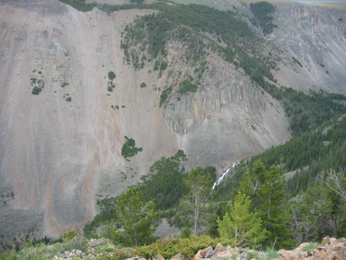
View North and Way, Way, Way, Down To a Side Stream In Wyoming Creek Canyon, Coming From The Southeast.
[ .... a little path] that takes us out to .... ]
First Roadside Rest Area Turnout, Rock Creek Vista Point, Beartooth Highway ~14 Miles South of Red Lodge, MT. As you can see along the bottom of the /\ Above /\ Photo, there is a Stone Wall. When the ZMM Traveler walks the little path, this is the view (and stone wall) at their right.
You can see at least one broadleaf tree, as well as the white rushing water of the , Wyoming Creek, -- way way ~ below!
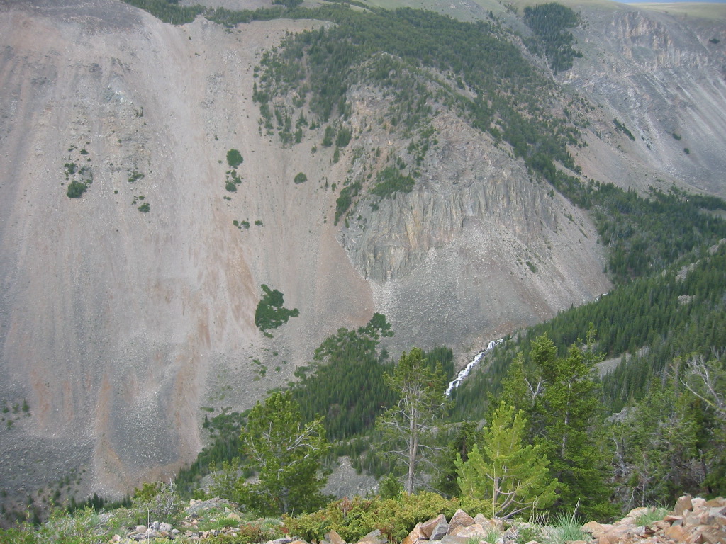
.The stones at the bottom of the /\ Above /\ Photo are at the edge of the wall. I had to lean way over this very solid protective stone wall to take this photo. The next photo shows the continued view to the left.
*************************
..INSTRUCTIONS HOW => TO SEE AN ONLINE TOPO MAP OF THE /\ ABOVE /\ PHOTO LOCATION AT THIS REST AREAs ROCK CREEK VISTA POINT.
..A) Short Instructions => Using The ONLINE Version of TopoZone Maps.=>
..1) On The Blue WayPt = Number Below => RIGHT CLICK AND SELECT NEW TAB =>
..2) After Map Comes Up => Use Scroll Bar At Far Right => Adjust Green Topo Map Until Upper Left => You SEE-JUST-BELOW The [[ Plus & Minus]] => [[Box]] => Click Go To Full Screen =>
..3) Use Plus & Minus To Zoom. You can ClickDrag Map In Any Direction to See More Off Your Screen Edges.
****
Suggestions To User: =>
..4) Although TopoZone Maps are a really great resource, they unfortunately do not mark the WayPt =
.
..5) When the TopoZone Map comes up, the WayPt = is in the Exact Center of your computer Screen.
..6) Suggestion => As best you can estimate, place a SMALL~Sticky Tag Pointer to mark screen center.=> Then Click-On => [[ Plus & Minus]] => AND IF=> your Pointer is CORRECT, it will still mark the same relative place on map.
..6) Since this ~Sticky Tag Pointer, will likely be useful when looking at a future TopoZone Map, I suggest you leave it there temporarily.
****
TopoZone Maps have successfully been used on my Windows & Linux Computers (both Firefox & Chrome).
.Please send email re how well this works for you on other computers/software.
..*************************..
FULL INSTRUCTIONS => Using The ONLINE Version of TopoZone Maps. AFTER this Page Comes Up, PLEASE** IGNORE** THE PHOTO & TOP HALF OF READING** YOU SHOULD IMMEDIATELY => SCROLL DOWN TO, AND READ => FULL INSTRUCTIONS. Click Here.
************************************
(Photo = 106-0617...... ZMM Page = 110...... WayPt = 135k )