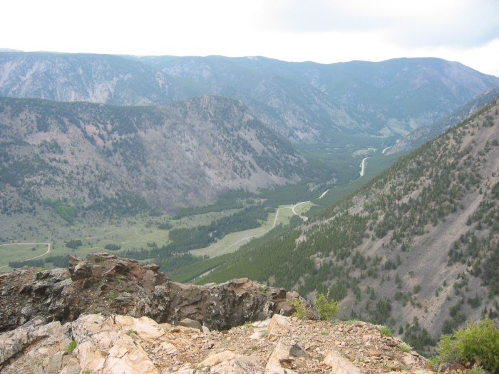
From The High-Up Rocky Promontory Rock Creek Vista Point, A View North
.You Can See The Tiny Road From Red Lodge, At The Bottom Of Rock Creek Canyon, Down-Stream.
. a little path that takes us out to the edge of a cliff.
Rock Creek Vista Point, First Roadside Rest Area, Beartooth Highway ~14 Miles South of Red Lodge, MT. The views are indeed breathtaking!... ! When I am at the edge of a high precipice, as happened here, I feel as if I am being drawn out of balance over the edge! So, I hang tightly onto the very solid secure railing, and just wait as calmly as I can until the queasy sensation gradually goes away.
.In the /\ Above /\ Photo => Where the tiny road disappears in the distance, you see two humps. The nearer hump is WayPt = 130w, where this U-shaped valley was first seen.
.. The exposed rocks you see are part of the Narrator's cliff. This is an original part of this major rock promontory, which owes its existence to the geological cutting action a side stream, Wyoming Creek, from the Southeast (see previous photo). This stream cut its deep chasm (perpendicular) to the main N-S canyon of Rock Creek seen here.
Thus this cliff is formed by the projecting corner of the intersection of these two deeply cut canyons. (These two respective canyon cuts will be seen more clearly in the 5th photo next. Or click on the Blue WayPt below for a topo map, which will show this Promontory, Parking Area, & Rock Creek Vista Point.)
.During Highway Construction, The Larger Parts Of This Rock Promontory (Nearer To The Mountain) No Doubt Were Chosen To Be A Service & Storage Area.
.This is because, as found, this area was wide and already somewhat level. The parking lot here was probably originally bulldozer leveled-off for a work-area plus a much needed place along these steep slopes to park construction machinery, and materials. Plus level space to have temporary work buildings, dormitories, etc. On these steep rockslide prone slopes, such needed places are hard to come by!
. For the NEXT PHOTO, I turned my camera left, which also shows more of these cliff-edge close-up exposed rocks.
*************************
(Photo = 106-0616 ...... ZMM Page = 110...... WayPt = 135m )