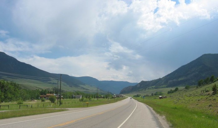
.... A View Looking South => The Valley Is Getting Narrower.
.The Line of Trees at Left Is the only Indicator of the Stream..
Beartooth Highway ~ 5 Miles South of Red Lodge, MT
My notes say: Now Getting Into the Valley Entrance. Cloudy and colder. There is no ZMM passage here, because the Narrator leaves out any mention of the scenery prior to the first mountain road switch-backs. Despite this, I thought you should see this and the next two photos of the scenery on the way there. Remember this valley size and contrast with that of the valley in the next photo.
.Also, begin to study and remember how the line of trees in an otherwise grassy expanse is the indicator of a major stream, as you see here.
Montana Scenic Byway: Beartooth Highway & The Bear's Tooth. =>
. [[A Brief History, From Which The Below, Is An Excerpt.]]
Information Concerning =>
...:a) Region: Southern Montana and Northern Wyoming East of Yellowstone National Park
....b) Length: 64 miles.
....c) Endpoints: Red Lodge, MT & Cooke City, MT
....d) Features: A huge plateau above 10,000 feet with alpine lakes, glacier-carved cirques and fragile tundra
....e) Side Activities: Hiking, fishing, 4-wheeling
..**********************..
....It had been a long August during the summer of 1882. General Phillip Sheridan, famed Civil War veteran, had led his group of over 120 men out of Fort Washakie in western Wyoming at the beginning of the month. By the last week of August, the inspection tour had crossed the Gros Vente Mountains and followed the Snake River into Yellowstone. The area had recently been designated a national park and already tourists had flocked to the area.....
....The General moved his men up the Lamar River on the east side of Yellowstone to a mining camp near Cooke City. Now he faced a three-day march down the Clarks Fork River before turning back north for Billings, Montana, where he would meet the Northern Pacific Railroad to take him to Chicago.....
....An old hunter by the name of Geer approached the General. Geer claimed that he had an intimate knowledge of the Beartooth Mountains which blocked the direct route to Billings, necessitating the circuitous detour down the Clarks Fork. Much against the advice of his comrades, and maybe partly to satisfy a hankering for going where no party had gone before, Sheridan listened and resolved to follow the hunter. Two days later, despite forest fire and snow drifts 40 feet deep in craters, the group completed the first crossing of the Beartooth Mountains, landing near present-day Red Lodge, Montana.
....Fifty years later, in 1936, the Beartooth Highway opened along Sheridan's route. Designated a National Scenic Byway in 1989, the Beartooth has been blessed as "America's most beautiful road" by no less an expert than Charles Kuralt.
(Excerpt Continued Next Photo.)
*************************
(Photo = 106-0602c ...... ZMM Page = NA ...... WayPt = 128k)