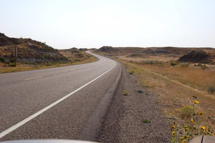
Here US-12 Goes Down Into The Dry Stream Channel Ahead, Then Does A Dramatic S-Curve To Cross It Perpendicularly, and Then Goes Up And Over A Road Crest Ahead.
.[ .. John comes over dripping with water and says, "You go ahead this time, well stay behind." .. "I wont go fast," I say. .. "Thats all right," he says. "Well get there. ]
..****************..
Along US-12, Mile Post 35: Just Over A Mile East of Powder River & Locate, MT. And ~37.6 Miles West of Plevna, MT.
A) In /\ Above /\ Photo, Notice The Road Cut At Left.
.Here you see another example of multi-colored layers of volcanic dust, giving evidence of very long history of eruptions, through eons of time, likely from Yellowstone National Park. These YNP massive volcanic eruptions were some 350 miles away to Southwest. All along US 12, you will see more examples of these light grey layers, sometimes multi-colored, in the roadside scenery or rode cuts,
In /\ Above /\ Photo, Notice TYellow Flowers, Whth Red Center, At Right.Please Email Henry Gurr, if you know the name of these, or send your Favorite Link Explaining Their Biology.
.
The Next Photo Shows The Road, On The Way Down, The After the Above Mention Crest in the Road, And Shows =>A Grand View of The Powder River Valley.
*************************
(Photo = Summer 2006 0390 ...... ZMM Page = 077 ...... WayPt = Approx 0.6 miles East of 2002 WayPt =093`)