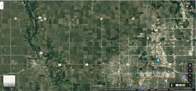
This Google Earth Satellite View Of West Central Iowa USA, Shows (Faintly) The Track Bed Of The Minneapolis and St Louis Rail Road (~1870-1960), Which Is Now The Trace of The Raccoon .River Valley Trail , A Very Nice Parkway For Hikers & Bicyclists! =>
A) You Can See At Lower Right, The Massive Human Infrastructure of Des Moines IA!!!
B) And If You Follow US 6, You will see word Waukee (IA), This will help you identify
C) The Faint Trace of the old railway line NW, straight through Dallas Center (IA), and continuing straight off the upper edge of the screen.
D) All of this (and even more miles), are NOW is the most pleasant Raccoon .River Valley Trail , A Very Nice Parkway For Hikers & Bicyclists! .
This RRVT Parkway, as seen in Dallas Center IA, is shown in the Next Photo Panorama.
You May Explore This Google Earth Satellite View, Yourself Here.
Click Here For ZMMQ Photo Gallery Detailed Full & Complete Viewing Instructions For ZMMQ Gallery Albums & Photos, Including Slide-Show.